Advocacy Alert: Map Update
CBP has changed the project map. Shumla’s September 22 review found that the revised route moves closer to Panther Cave and Rattlesnake Canyon. Shumla is asking officials to pause irreversible work, explain the change, and review the project’s need and impacts before work proceeds.
Take actionSign the petitionThe route has changed. Public review should keep pace.
Ask the officials responsible for Big Bend Project 5 to explain the changed route, demonstrate the need, consult affected communities, assess impacts, and evaluate lower-impact options before irreversible work proceeds.
Contact officialsWhat changed?
Shumla’s September 22, 2026 GIS review found that the current proposed route moved closer to the Rio Grande west of Eagle Nest Canyon and closer to Highway 90 elsewhere. It now runs much closer to Panther Cave and Rattlesnake Canyon. CBP provided no public notice of these route changes.
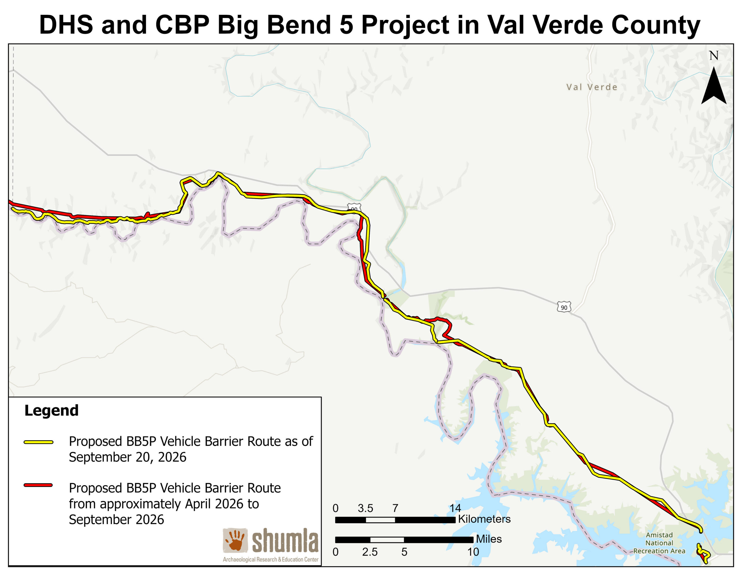
The map legend dates the current proposed route to September 20, 2026. Shumla’s GIS review of route and site impacts is dated September 22, 2026. The two dates refer to different materials.
For CBP’s official project mapping, see the CBP Smart Wall Map. The comparison maps above are Shumla’s map materials.


Route and impact figures reflect Shumla’s GIS review dated September 22, 2026.
Deep history and living cultural meaning
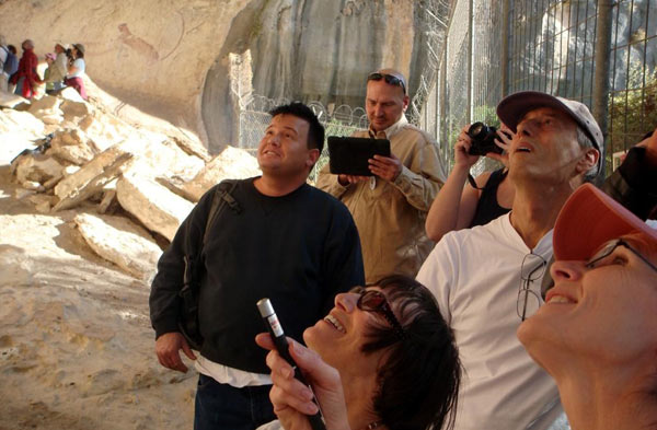
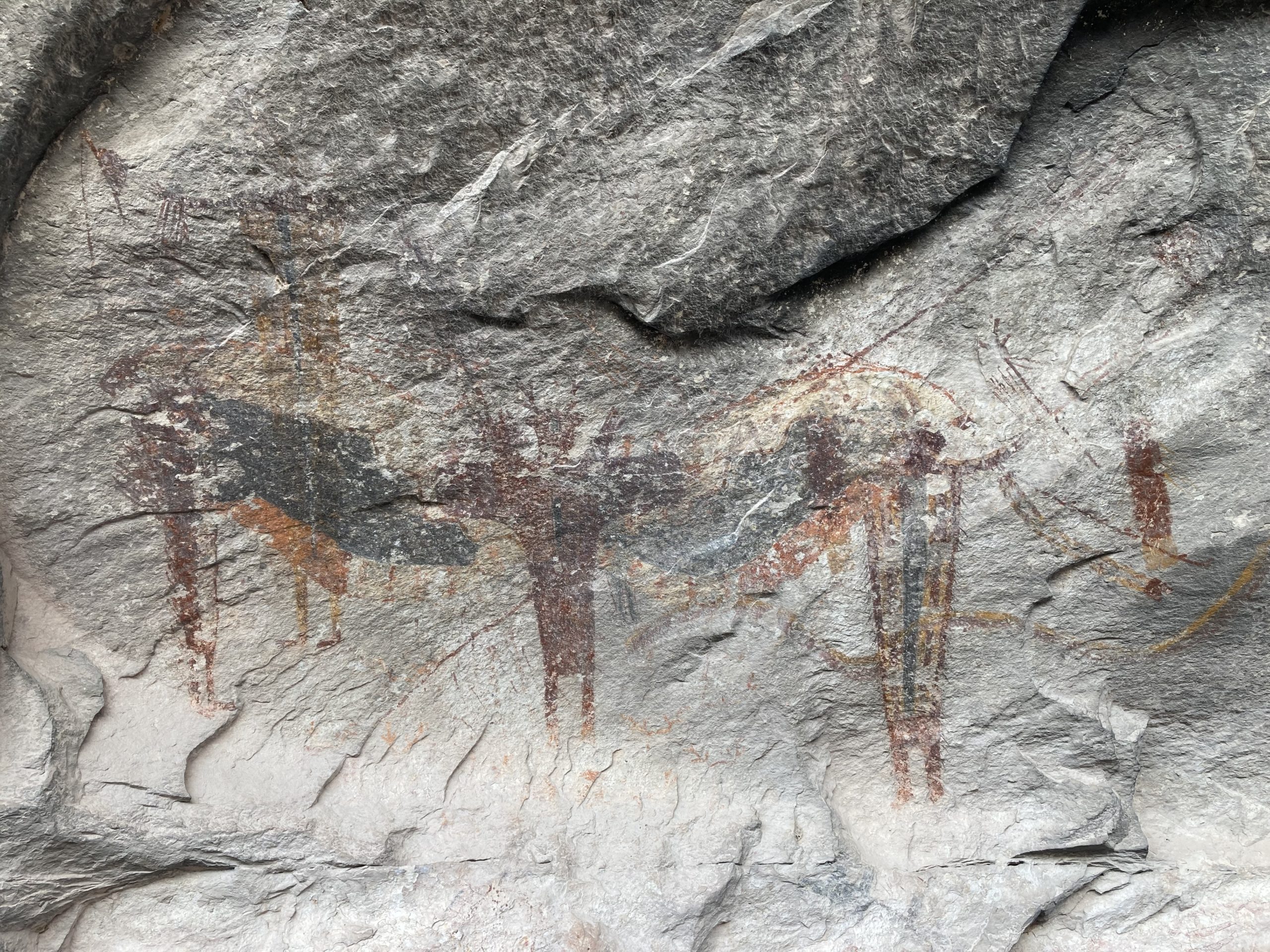
The Lower Pecos murals are large, carefully composed works made over thousands of years. These photographs show the shelter setting and the detail of the painted panels. Select a photo to view it full size.
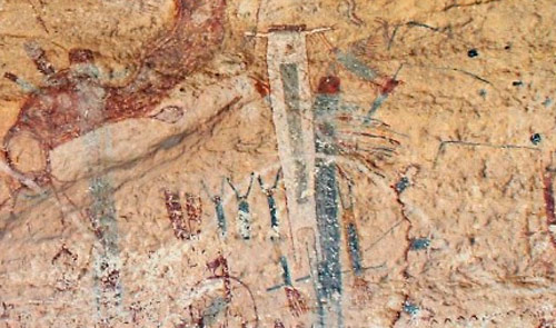
Panther Cave
Located in Seminole Canyon State Park and Historic Site, Panther Cave contains a world-renowned mural extending more than 200 feet, with hundreds of painted images.
Rattlesnake Canyon
Rattlesnake Canyon houses five rock art sites spanning a quarter mile, including an extensive mural complex with more than 350 painted figures.
The Lower Pecos Canyonlands
People began painting in the Lower Pecos nearly 6,000 years ago. The Pecos River tradition continued for more than 4,000 years across at least 175 generations, while Red Monochrome and Historic Period paintings extend the region’s rock-art record across later periods. These places remain part of living Indigenous heritage.
Approximately 64,908 acres would lie on the river side of the proposed barrier. This area includes public lands, private ranches, and Seminole Canyon State Park and Historic Site; barriers and related infrastructure could affect access to land, water, grazing areas, and public sites.
Pause, explain, consult, and review alternatives
Shumla believes effective border security and protecting our cultural heritage are not mutually exclusive. Before irreversible work proceeds, Shumla is asking DHS and CBP to:
- Pause construction, surveying, property access, and approvals that could cause irreversible effects while the changed route and impacts receive public review.
- Explain the route change and demonstrate the operational need for the proposed infrastructure in this terrain.
- Protect Seminole Canyon State Park and Historic Site, Panther Cave, State Antiquities Landmarks, and the Lower Pecos Canyonlands Archeological District National Historic Landmark.
- Consult affected private landowners and Tribal communities before decisions become irreversible.
- Assess effects on archaeological sites, rock art, working ranches, public lands, park resources, and public access.
- Evaluate cumulative effects from barriers, roads, grading, blasting, lighting, staging, drainage changes, and long-term access restrictions.
- Consider non-invasive, non-destructive approaches such as solar-powered autonomous surveillance towers, drones, satellite monitoring, and boots-on-the-ground patrols, alongside other site-specific tools that can meet the mission with fewer permanent impacts.
The cost deserves a clear public explanation
DHS awarded a $2.594 billion design-build contract for Big Bend Project 5, according to the project information summarized in Shumla’s update. Before committing public funds to infrastructure that could cause lasting effects, DHS and CBP should explain the operational need, show how the cost is justified, and compare lower-impact options.
Contact the officials responsible for the project
Start with offices that have direct authority over project decisions. Include your home city and ZIP code so elected offices can identify you as a constituent. Add a personal sentence about why the Lower Pecos matters to you.
Who to contact
| Office | Who | What to ask |
|---|---|---|
| U.S. Department of Homeland Security | Secretary Markwayne Mullin | Ask DHS to pause irreversible work, disclose the route change, document need, and direct CBP to evaluate lower-impact options. |
| U.S. Customs and Border Protection | Commissioner Rodney S. Scott | Ask CBP to explain the changed route, demonstrate operational need, assess cultural-resource impacts, and evaluate non-invasive alternatives. |
| Texas Governor | Governor Greg Abbott | Ask the Governor to intervene for Seminole Canyon State Park, Texas landowners, and Texas cultural heritage. |
| U.S. Senate | Your U.S. senators | Ask for a written DHS response and oversight of the route change and consultation process; urge DHS and CBP to pause irreversible work pending review. |
| U.S. House | Your U.S. representative | Ask for a written DHS response and oversight of the route change, project need, consultation, and alternatives. |
| Texas Parks and Wildlife | Commission and Executive Director | Ask TPWD to withhold access or approvals that threaten Seminole Canyon until impacts and alternatives receive full review. |
| Texas General Land Office | Land Commissioner | Ask the GLO to defend Texas public land and insist on lawful, transparent access. |
| Texas Legislature | Your state senator and representative | Ask them to review effects on Texas public lands, private property, cultural resources, and local communities, and raise concerns with relevant state agencies. |
Find your U.S. representative · Find your Texas officials · U.S. Capitol switchboard: 202-224-3121
Short contact message
For a contact form or brief email.
Show and copy short message
Phone script
A short call to an official’s office.
Show and copy phone script
Full constituent letter
Personalize it and select the request that fits the office.
Show and copy full letter
Texas leadership letter
Focus on Texas land, park access, and cultural resources.
Show and copy Texas letter
Read more about Shumla’s response
The action tools above help visitors contact officials. These documents provide more context for people who want to read Shumla’s statement, the Board’s position, or Dr. Carolyn Boyd’s letters.
Press release
Shumla’s public statement on Big Bend Project 5.
Read the press releaseBoard resolution
The Board’s resolution on stewardship, science, consultation, and cultural resources.
Read the Board resolutionLetters from Dr. Carolyn Boyd
Read Dr. Boyd’s letters about Big Bend Project 5.
Read Dr. Boyd’s lettersFrequently asked questions
Does Shumla oppose border security?
No. Shumla believes effective border security and protecting cultural heritage are not mutually exclusive. Shumla asks DHS and CBP to demonstrate this project’s operational need and consider non-invasive, non-destructive approaches that can meet the mission with fewer permanent impacts.
What does “river side of the barrier” mean?
It refers to land between the proposed barrier and the Rio Grande. This is clearer than “south of the barrier” because the river and route do not follow a straight east-west line.
Are these numbers current?
These figures reflect Shumla’s GIS review from September 22, 2026. CBP may change the route, so Shumla dates each update. Check this page for the latest review.
Why should I personalize my message?
Your city and ZIP code help an elected office identify you as a constituent. A short personal note about why these cultural places matter to you makes your message your own.
What is Shumla asking elected officials to do?
Shumla is asking officials to use their authority to seek a pause on irreversible work, request a public explanation, review project need and impacts, consult affected communities, and consider lower-impact options.
What could the project affect?
Potential effects include archaeological sites, rock art, working ranches, public lands, park resources, land and water access, and public access. A full review should assess direct and cumulative effects.