Welcome to the Shumla Blog!

The Lower Pecos Canyonlands of southwest Texas and northern Coahuila, Mexico is home to some of the world’s most complex prehistoric art (Boyd 2003, 2016; Shafer 2013; Turpin 2010). The visual and material culture characterizing the region and its prehistoric inhabitants extends approximately 110 km north and 150 km south of the United States-Mexico border (from Sheffield, Texas, to the Arroyo de la Babia in Coahuila, Mexico). From east to west, the region stretches approximately 125 km between the communities of Carta Valley and Dryden, Texas. Over four thousand years ago, hunter-gatherer artists began transforming this arid region into a painted landscape, and today the rock art of the Lower Pecos is known to be some of the oldest rock art in North America (e.g. Bates et al. 2015). The majority of the known Lower Pecos rock art north of the US-Mexico border is in Val Verde County. Due to the age of many of these sites, some of the paintings are being lost due to natural impacts (e.g., sun exposure, spalling, flooding, etc.).

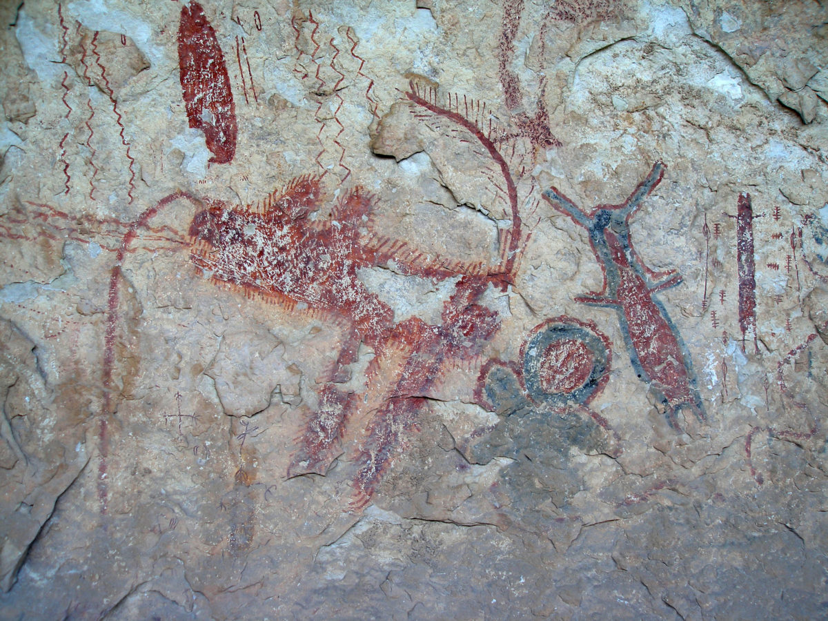
Pecos River Style
Pecos River Style from Halo Shelter. Photograph by Jean Clottes.

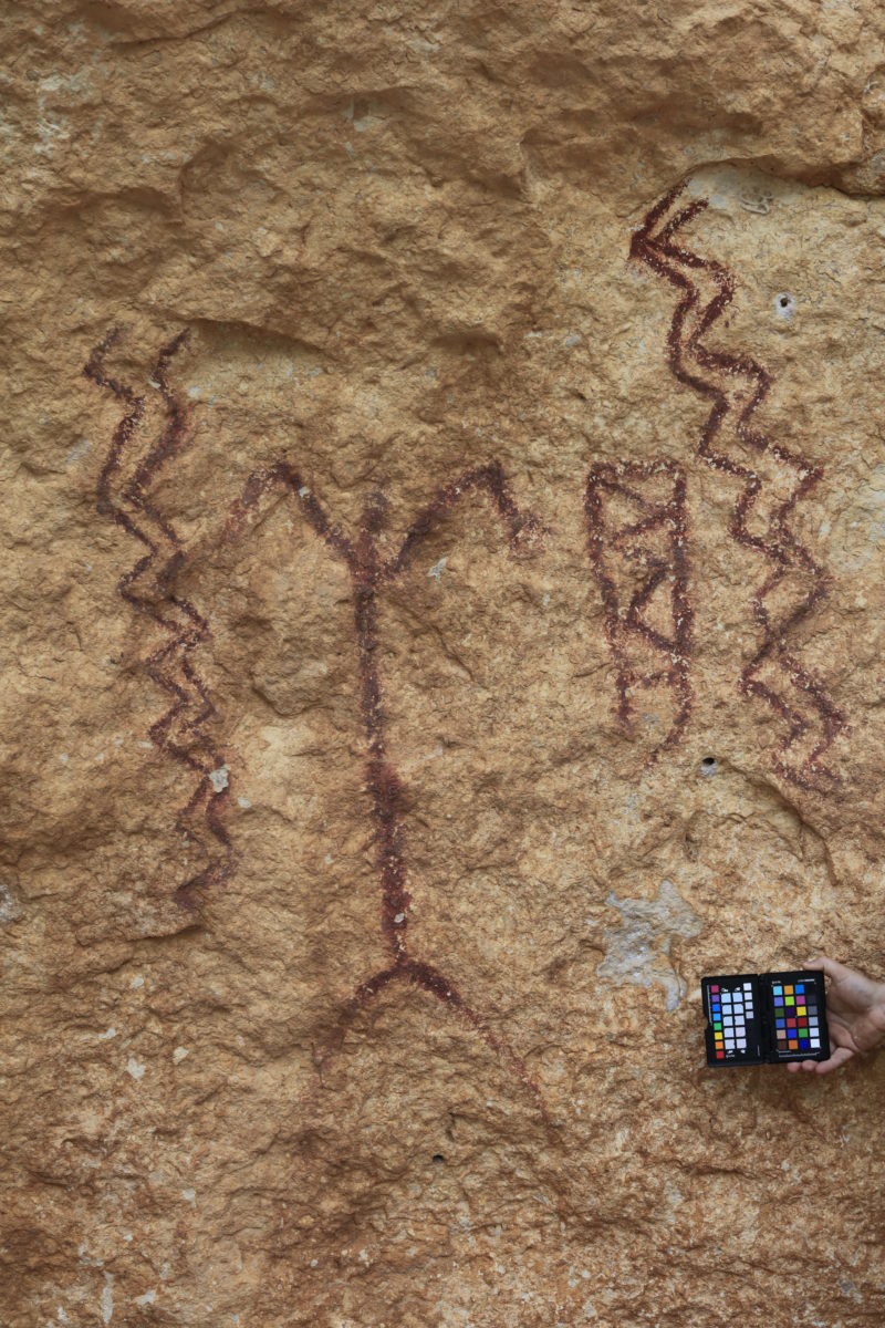
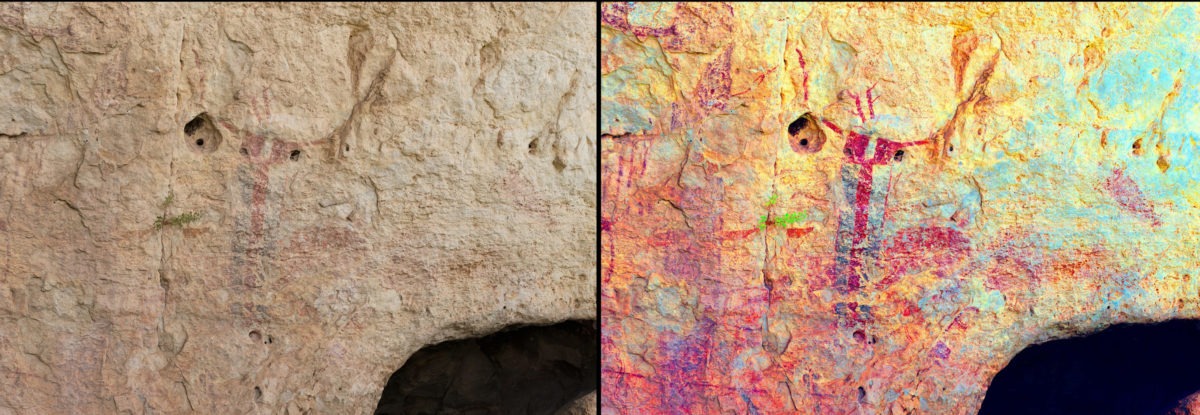
Red Linear
Red Linear Style from 41VV201.
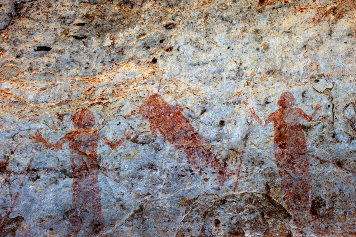
Bold Line Geometric
Bold Line Geometric from 41VV1438.
Red Monochrome
Red Monocrhome Style from Painted Shelter. Photograph by Jean Clottes.
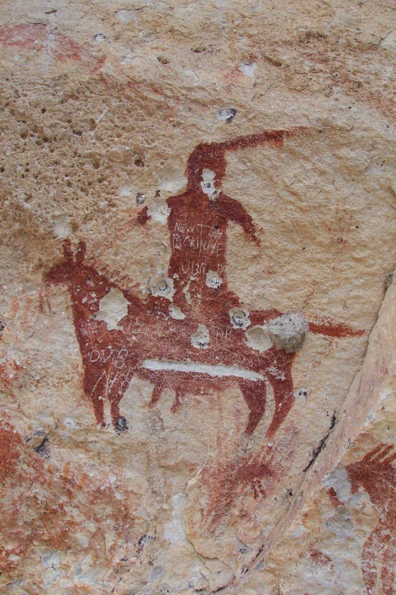
Historic
Historic Rock Art from Meyers Springs.
Petroglyphs
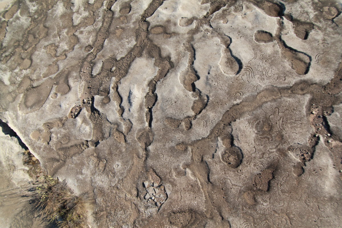
Petroglyphs from Lewis Canyon.
The most common rock art style in the region is Pecos River Style, famous for the large, multicolored murals that adorn numerous Lower Pecos rockshelters and caves. Based on the work by Shumla’s founder, Dr. Carolyn Boyd, many of the Pecos River Style murals are complex, planned compositions that were created to communicate the Lower Pecos hunter-gatherer’s beliefs, understanding of the natural and supernatural world, and their place within the cosmos.
Although Shumla and other researchers have intensively studied the Pecos River Style images, Lower Pecos hunter-gatherers produced a diversity of other images that have been less-studied, but are no less important for understanding Lower Pecos foraging peoples. All of these images and sites together create a large, complex, and enduring library of information that provide clues into the prehistory of the region.
The Alexandria Project
Of the more than 300 known rock art sites in Val Verde County, few have received the detailed documentation and iconographic description crucial for studying and protecting these endangered sites. This past August Shumla launched our most ambitious documentation project to date, with the goal of conducting baseline documentation at all of the known rock art sites within Val Verde County.
The project name, The Alexandria Project, harkens back to the Library of Alexandria in Egypt, which burned in 48 BC. A staggering amount of knowledge about ancient philosophy, astronomy, and mythology was destroyed in that fire. As though we had discovered a room of the lost library of Alexandria, we have built a three-year research and data management plan to fully catalog and digitize this treasure of knowledge and ensure that every image is available to researchers for years to come.

- To collect data that can be used to address a variety of research questions and inform Lower Pecos rock art research/scholarship for years to come.
- To determine the threatened status of rock art sites and to prioritize future documentation efforts accordingly.
- To build stronger relationships with local landowners, land managers, and site stewards.
- To share what we learn and increase public awareness in the importance of preserving and protecting these rock art sites for future generations.

Alexandria Data Collection
Since 2007, Shumla has focused our data collection on intensively documenting individual sites like White Shaman, Panther Cave, and Rattlesnake Canyon. This approach is invaluable for learning about the iconography present at a single site, but the entire data collection process is very time consuming because of the meticulous, labor intensive methods we employ. For instance, full documentation of a large site can take upwards of three years because of the sheer volume of data collected. While this level of documentation is incredibly important, we recognize that for many sites time is running out. In response, Shumla has resolved to conduct baseline documentation for all known and accessible rock art sites in Val Verde County in just three years of intensive field work.
Shumla’s baseline documentation methods can be split into three levels of data collection: (1) Core Data; (2) High-Resolution Panel Data; and (3) Specialty Analysis Data. Core data include a standardized archaeological site form (TexSite), site maps, daily recording notes, GPS points, and site context photos. All of these data together document the current condition of the entire archaeological site, and give future researchers more specific information about the rock art present at the site. Also included in the Core Data is rock art specific information recorded on our Shumla Rock Art Site Form. These data will allow researchers to search for specific styles, look for patterns in causes of rock art deterioration, as well as specific iconographic symbols and motifs (look for more on this topic in a future blog post!).
Iconographic Inventory PDF

High Resolution Panel Data
For collecting High-Resolution Panel Data we use three primary techniques:
- Structure from Motion (SfM) 3D modeling,
- GigaPan photography, and
- General Panel Photography.

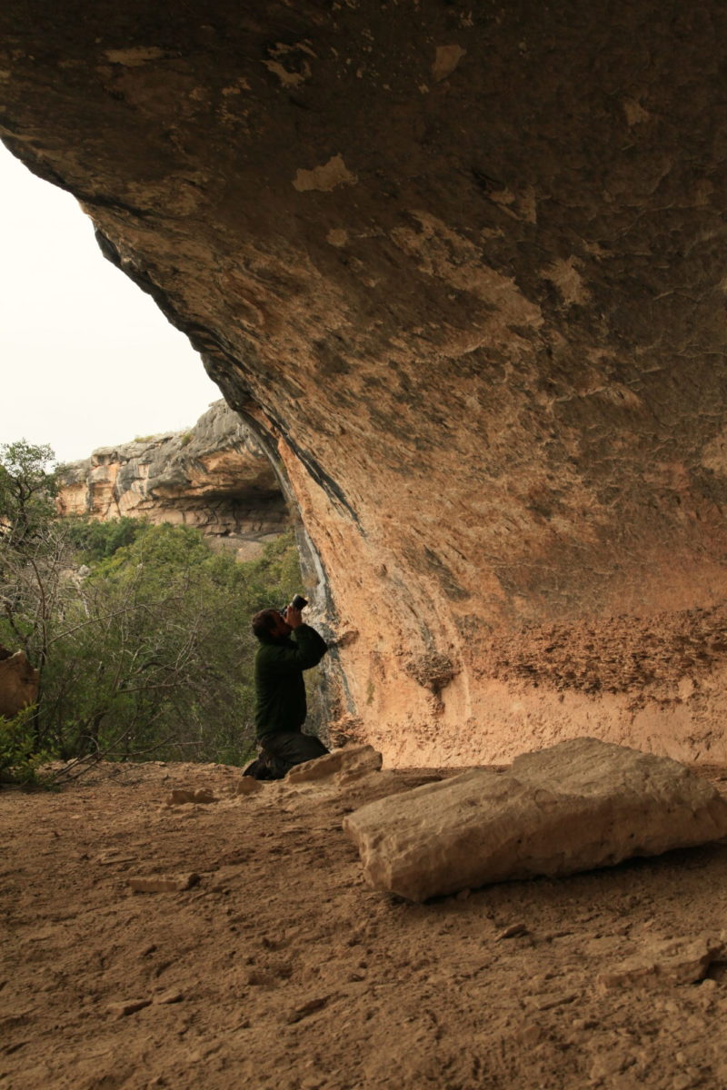
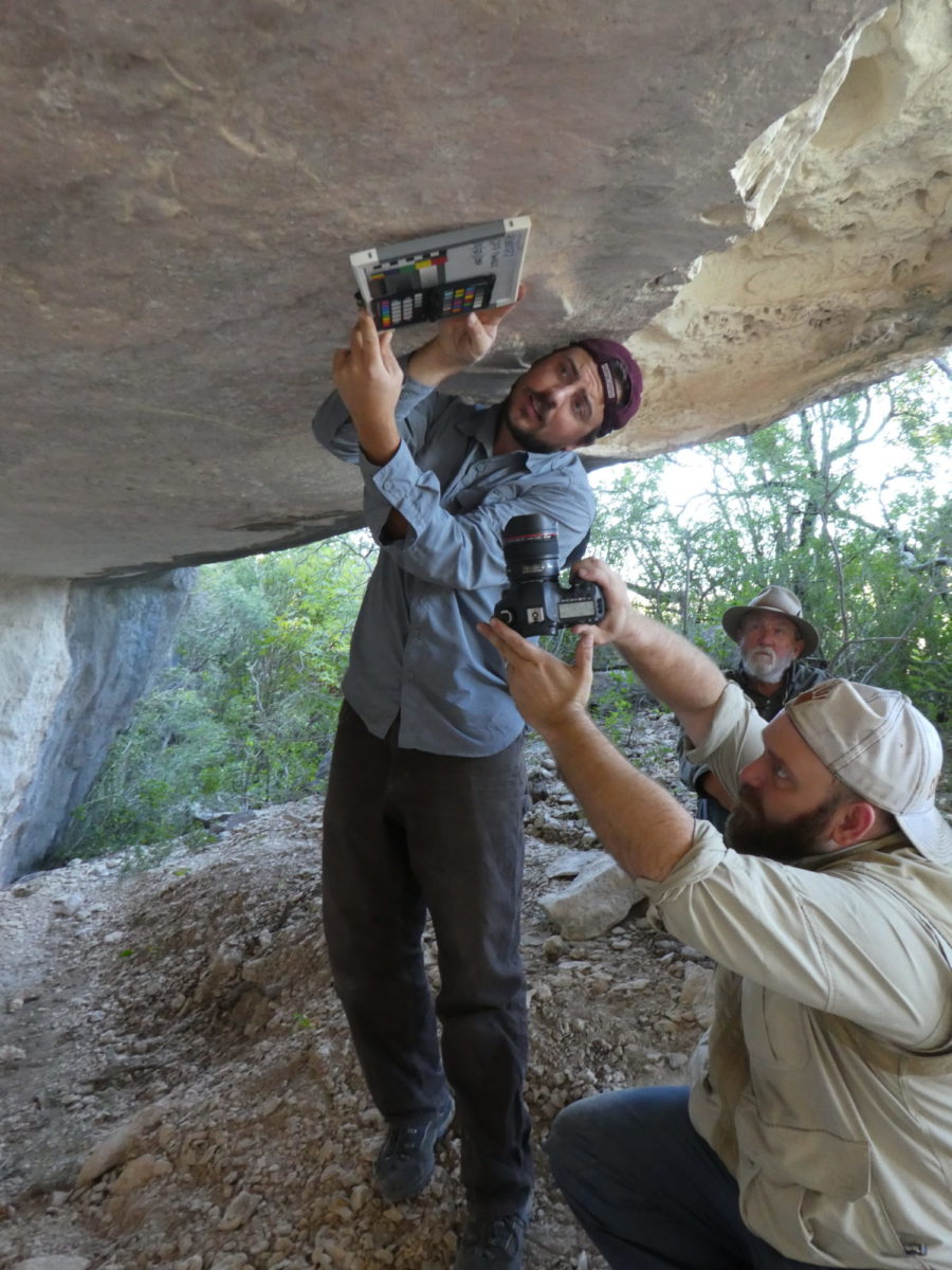
Amanda Castaneda taking SfM photos in Grind-Away Hide-Away.
Amanda Castaneda taking SfM photos in Grind-Away Hide-Away.
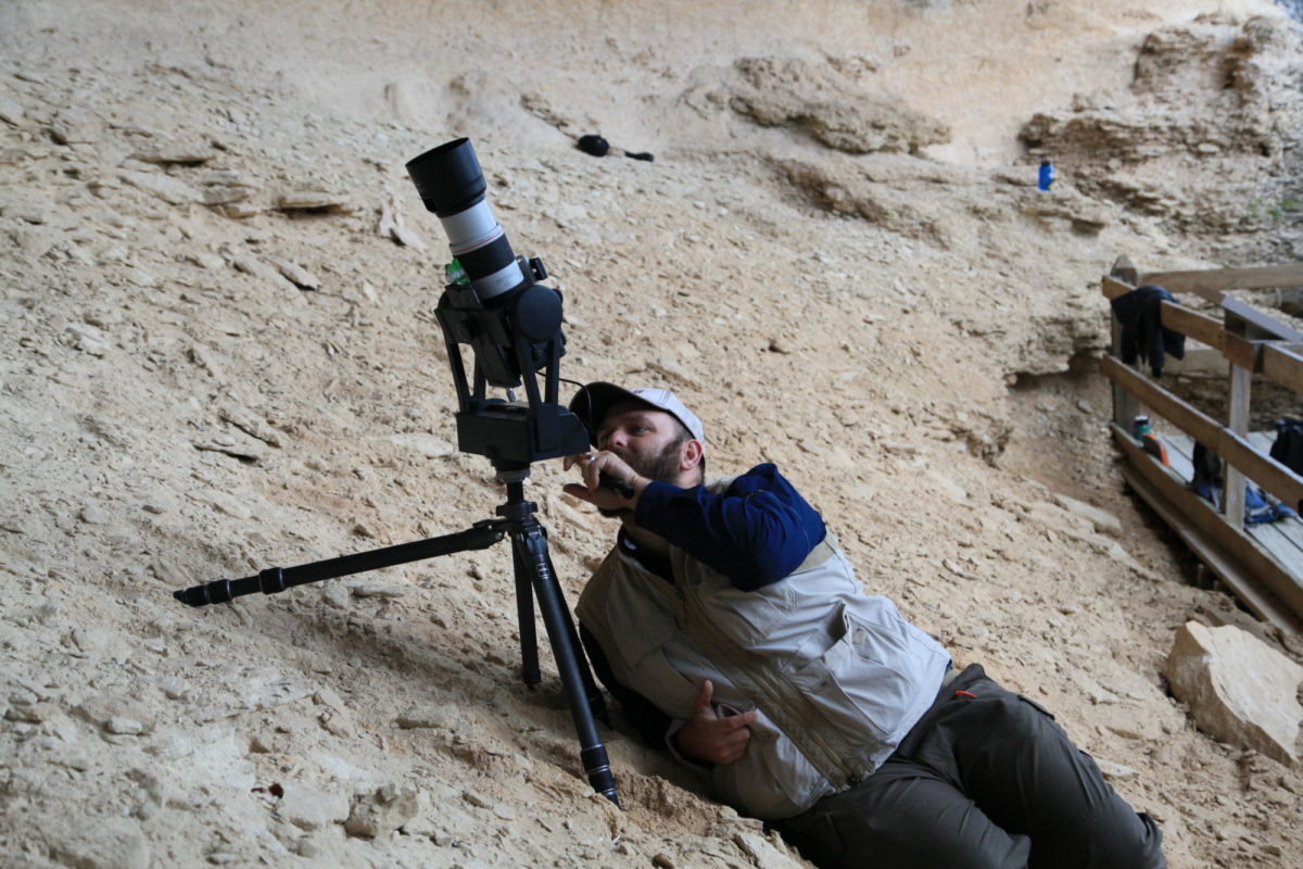
Charles Koenig taking SfM photos in Fate Bell Annex.
Charles Koenig taking SfM photos in Fate Bell Annex.
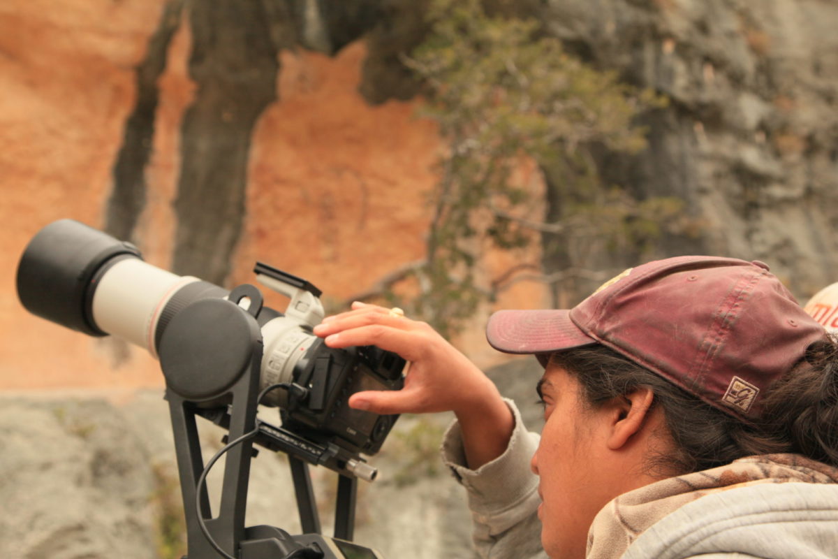
GigaPan at Black Cave Annex
Vicky Roberts taking GigaPan photos at Black Cave Annex.
GigaPan at Fate Bell Annex
Jerod Roberts taking GigaPan photos in Fate Bell Shelter.
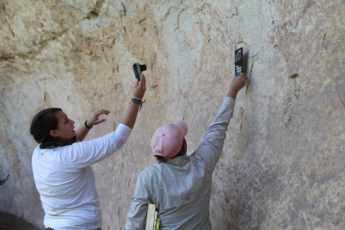
Amanda Castaneda, with assistance from volunteer Betty Koenig, taking GPP photographs.
Amanda Castaneda, with assistance from volunteer Betty Koenig, taking GPP photographs.
Charles Koenig holds a mugboard as Jerod Roberts takes General Panel Photographs.
Charles Koenig holds a mugboard as Jerod Roberts takes General Panel Photographs.
GigaPan Images:


Specialty Analysis Data
The final level of data we collect on-site is what we consider Specialty Analysis Data. Specialty Analysis Data is primarily comprised of high-resolution photography of known motifs present across the Lower Pecos. At the moment we are only collecting these data on three reoccurring motifs: Otherworld Journey, Peyotism, and Antlered Anthropomorphs.
Otherworld Journey Motifs (or OWJs) are relatively common images depicted in Pecos River Style. Typically, OWJs consist of two images, an anthropomorphic figure and a portal, and the anthropomorphs are in the process of passing though the portal. OWJs come in a variety of shapes and sizes, including the two examples below from Fate Bell Annex and Wiley shelter.
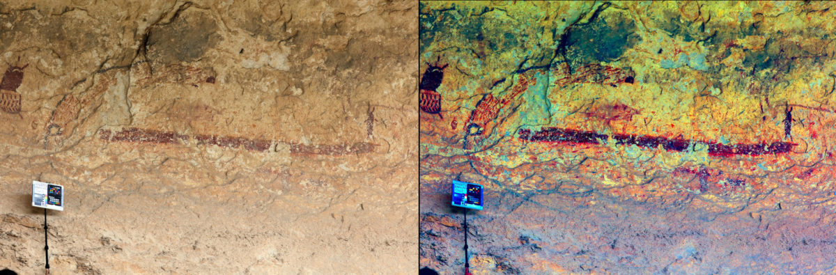
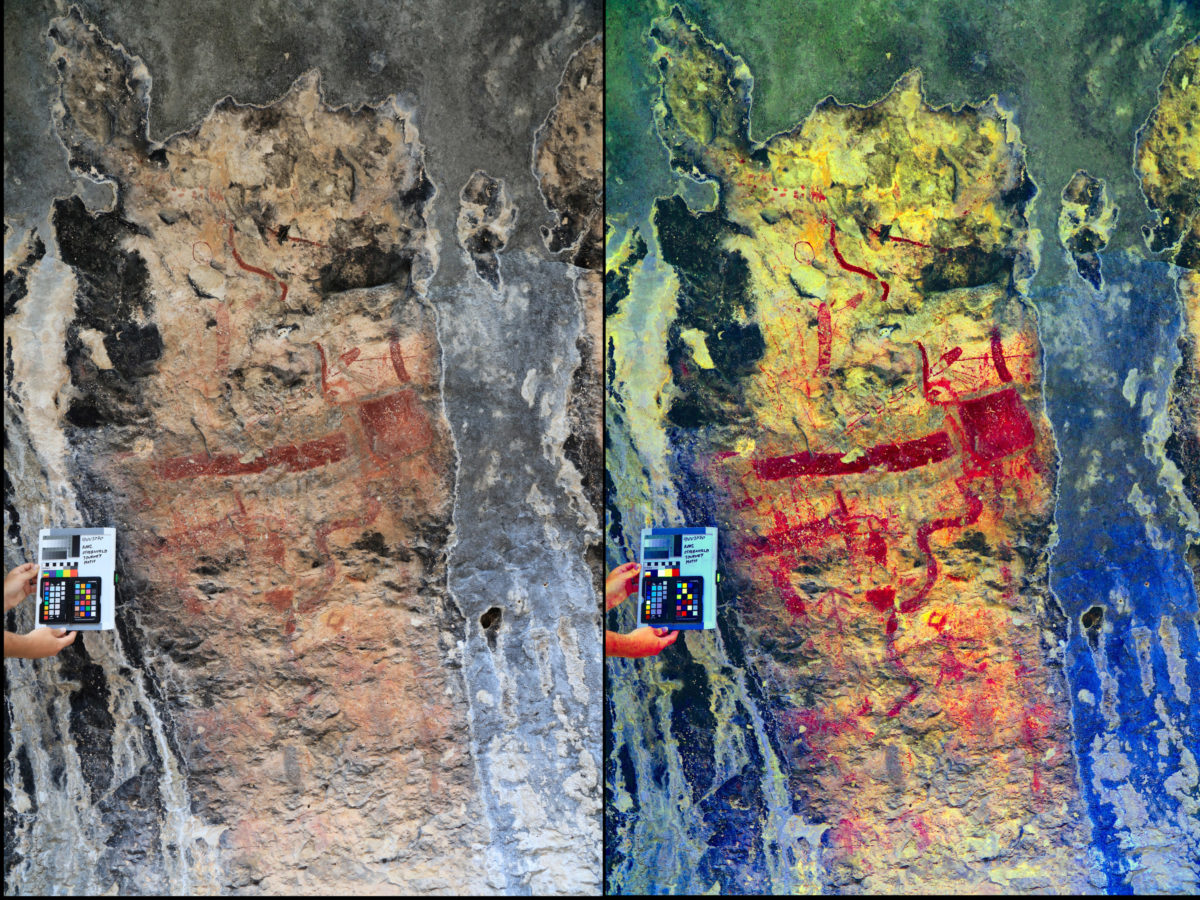

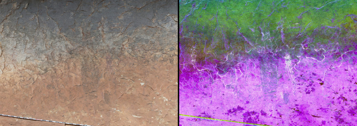
Additional Specialty Analysis Data includes portable X-ray fluoresce (pXRF) analysis of pigments to identify the elements present within the paints (e.g., Koenig et al. 2014), and occasionally we even collect stratigraphic data (looking at the paint layering) using a Dinolite microscope when we’re in the field. Watch for more details of these in future blog posts!
Alexandria Research Questions and Ongoing Data Analysis
Depending on the rock art preserved at a site, baseline documentation can take anywhere from a couple hours to two days. As we continue to collect data from different rock art sites, we are beginning the process of data analysis. Our data analysis is guided by several research questions that we have developed while planning for the Alexandria Project. These questions are:
- Are there patterns in rock art site location?
- Are there patterns in the spatial distribution of rock art styles and motifs?
- What is the range of variation of well-known motifs (e.g., Otherworld Journey, Peyotism, etc.)?
- Are there sub-styles within the Pecos River style?
- Investigating Red Linear in the Lower Pecos
- Are there any currently unknown rock art styles that exist in the region?
All of these questions can be addressed using the visual, iconographic, and geospatial information we collect as part of the Alexandria Project. The first step in addressing any of our research questions is processing the SfM 3D models, GigaPan panoramas, and entering all of our Rock Art Site Form data into our Shumla Rock Art Database. All of these data will allow us to begin searching for patterns in the rock art. Inevitably there will be additional questions that arise as we and future researchers continue to study this complex visual culture.
By using these methods at each site we are able to not only digitally preserve the rock art imagery for future generations, but also provide an unparalleled visual and spatial inventory of Lower Pecos rock art to inform current and future research. To date we have visited over 30 sites on our way to 300+, and at each site we visit we learn new information.
Follow our blog, Facebook, and sign up for our eNews to stay up to date with the Alexandria Project!
References Cited
Bates, Lennon N., Amanda M. Castaneda, Carolyn E. Boyd, and Karen L. Steelman
2015
A Black Deer at Black Cave: New Pictograph Radiocarbon Date for the Lower Pecos, Texas. Journal of Texas Archaeology and History 2:45-57.
https://drive.google.com/file/d/0B4p1SsI5fon7aG8waXRTQVFNVlU/view
Boyd, Carolyn E.
2003
Rock art of the Lower Pecos. Texas A & M University Press, College Station.
2016
The White Shaman Mural. University of Texas Press, Austin.
Kirkland, Forrest and W.W. Newcomb
1967
The Rock Art of Texas Indians. University of Texas Press, Austin.
Koenig, C.W., A.M. Castaneda, C.E. Boyd, M.W. Rowe, and K.L. Steelman
2014
Portable X-Ray Fluorescence Spectroscopy of Pictographs: A Case Study from the Lower Pecos Canyonlands, Texas. Archaeometry 56(S1):168-186
http://dx.doi.org/10.1111/arcm.12060
Shafer, Harry J (Editor).
2013
Painters in Prehistory. Trinity University Press, San Antonio, Texas.
Turpin, Solveig A.
2004
The Lower Pecos River Region of Texas and Northern Mexico. In The Prehistory of Texas, Ed Timothy K. Perttula. Texas A & M University Press, College Station.
2010
El arte indigena en Coahuila. Universidad Autonoma de Coahuila. Saltillo, Coahuila.
0 Comments