Time Does Not Heal All: Observable Deterioration in the Rock Art of Seminole Watering Hole (41VV72)
**This blog is based on the poster presented by Hailey LaRock and Caitlin Houle at the 2018 Texas Archeological Society Annual Meeting in San Antonio, Texas, titled: “Time Does Not Heal All: Observable Deterioration in the Rock Art of Seminole Watering Hole.” A PDF version of the poster is available at the bottom of this blog post.**
By Hailey LaRock, Caitlin Houle, and Charles Koenig
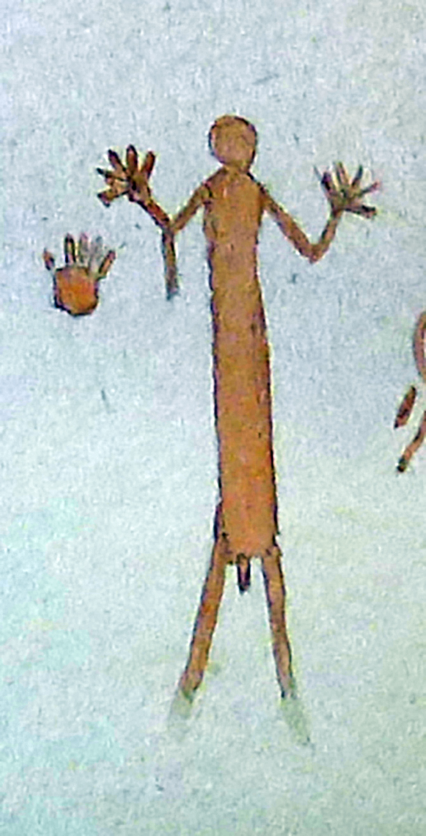
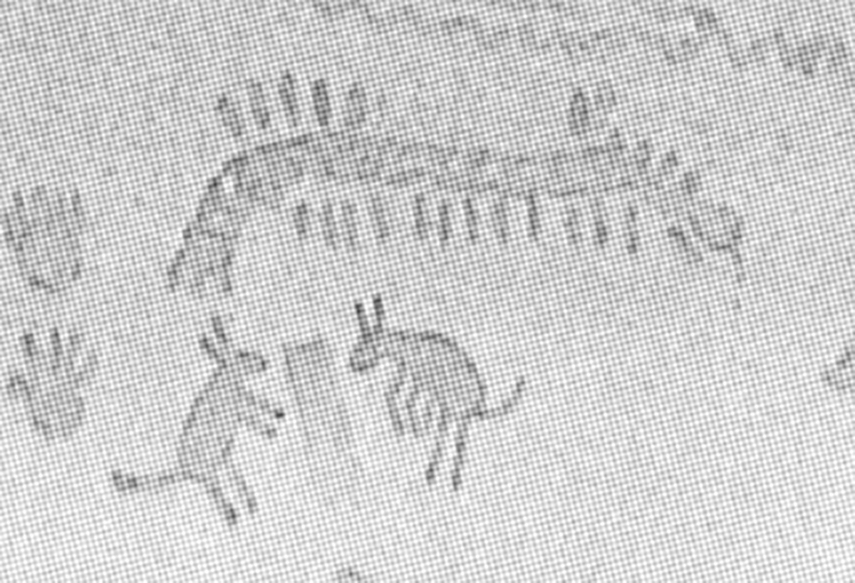
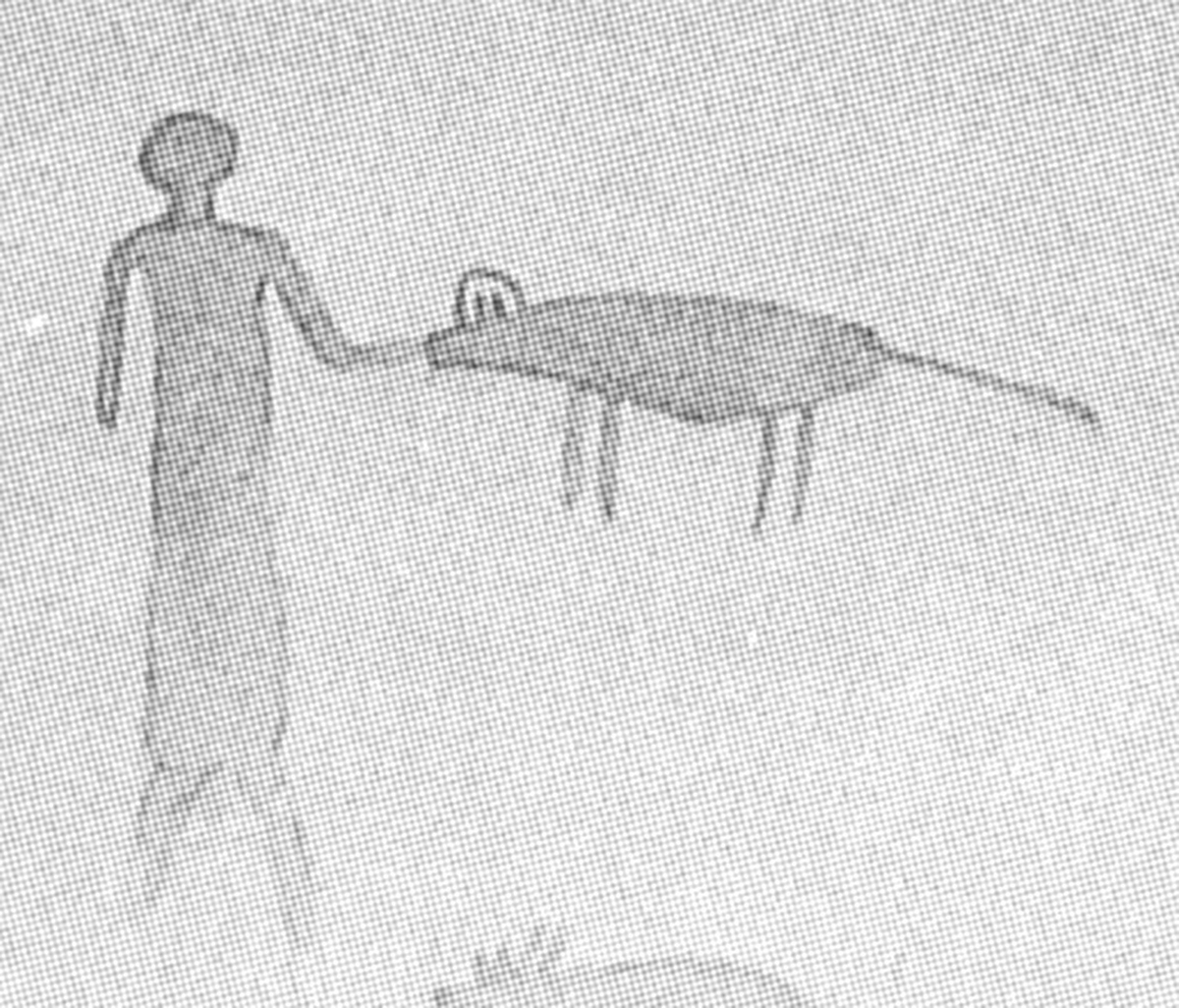
Seminole Watering Hole (41VV72) is a multi-component site located within Seminole Canyon State Park and Historic Site. The largest feature at Seminole Watering Hole is a massive rockshelter containing an elaborate, but deteriorated, mural of Red Monochrome Style rock art. In the 1930s Forrest Kirkland was one of the first to document rock art when he visited Seminole Watering Hole and produced watercolor renderings of the pictographs (Kirkland and Newcomb 1967). Kirkland called the Red Monochrome figures “Val Verde Flooded Shelter Style,” and Kirkland describes the images being in poor condition in the 1930s (Kirkland and Newcomb 1967:83).

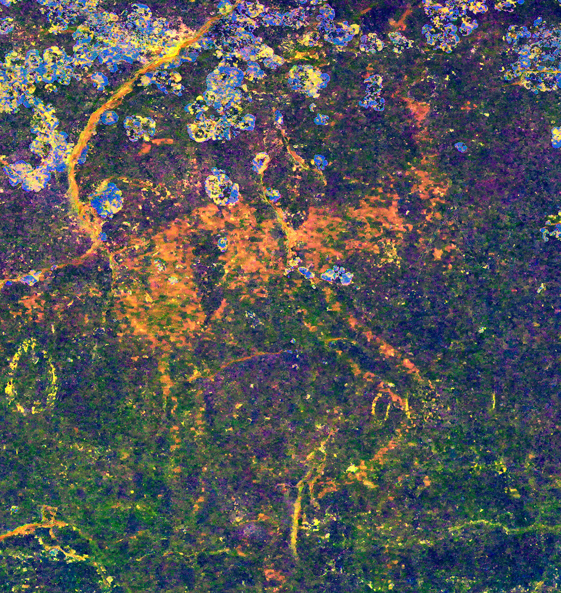
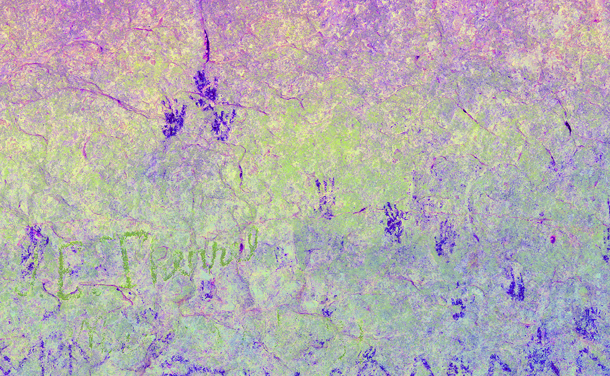
Even though the images were deteriorated, Kirkland was able to reproduce dozens of human, animal, and enigmatic figures spanning nearly the entirety of the shelter wall. In the proceeding years since Kirkland’s documentation his renderings have served as the primary record of the Red Monochrome pictographs preserved at Seminole Watering Hole. Shumla documented Seminole Watering Hole in 2018, and we were interested in assessing how much the pictographs had deteriorated since Kirkland produced his watercolor renderings. Using gigapanoramas and DStretch enhancements, we are able to identify imagery Kirkland illustrated that is no longer visible, and begin assessing how much the rock art at Seminole Watering Hole has deteriorated in the past 90 years.
 side of the image. There is another spring-fed pool in the downstream end of the site near the large boulders in the right side of the image.")
Red Monochrome
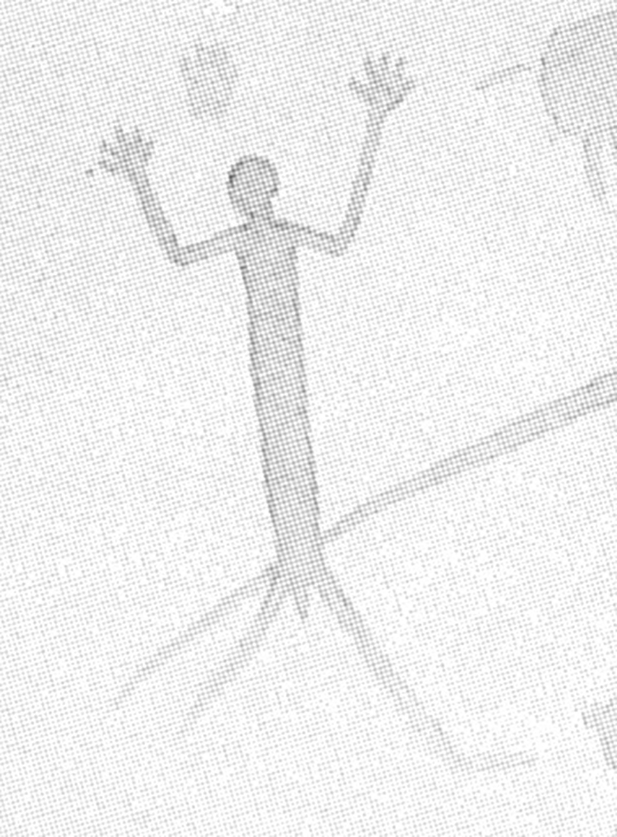
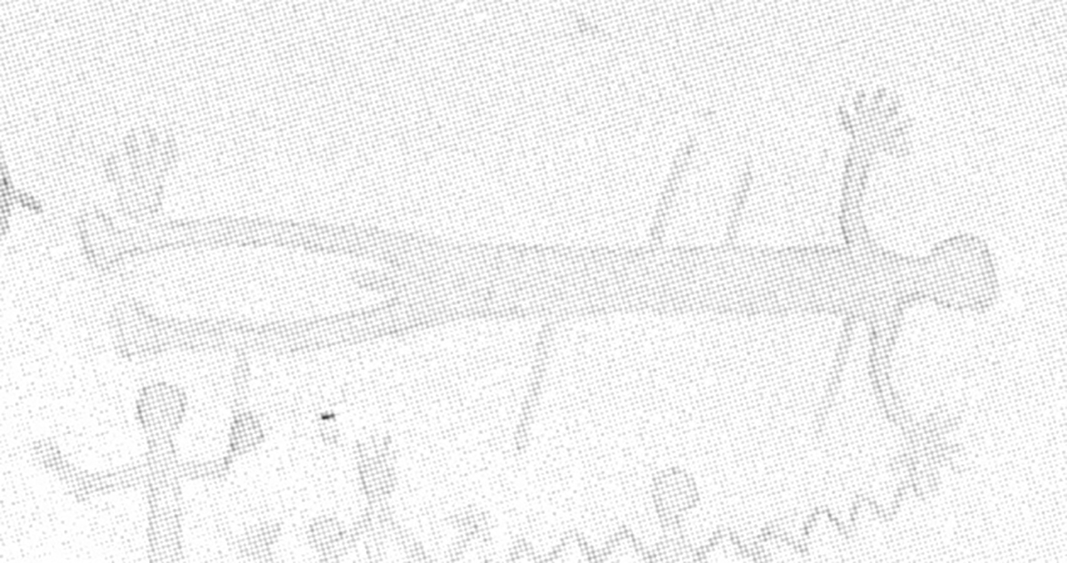
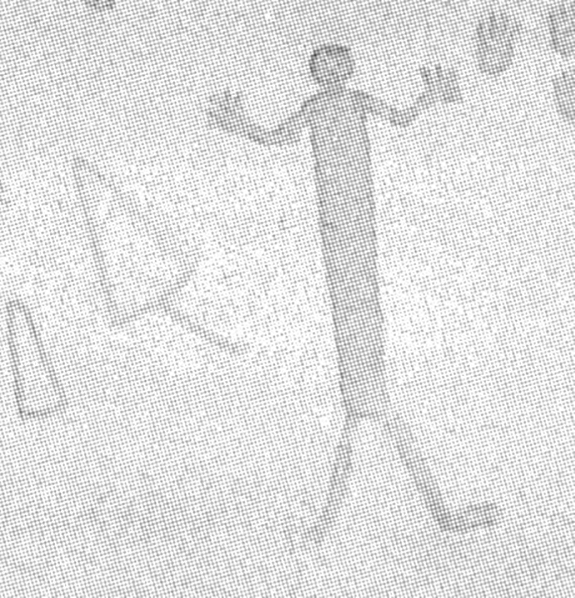
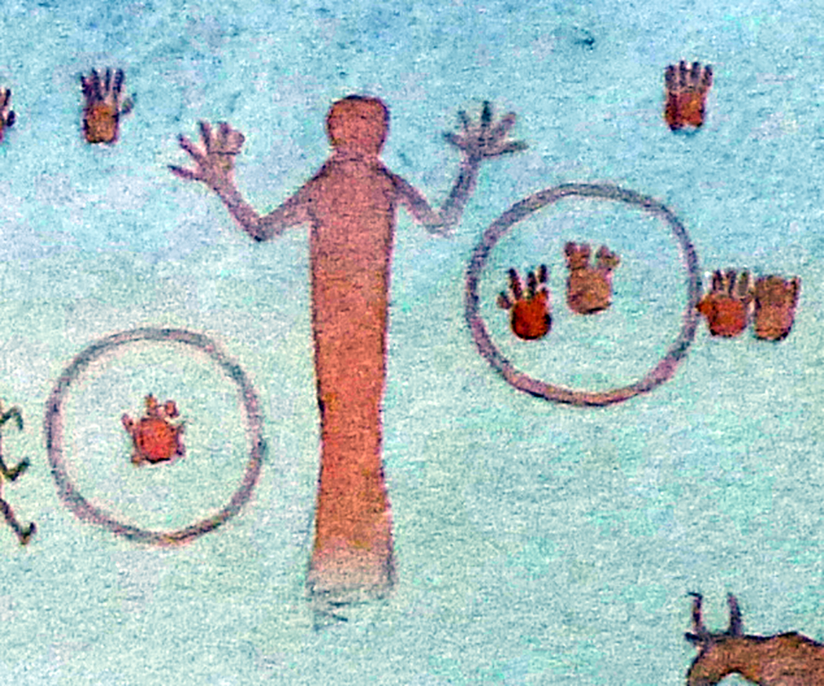
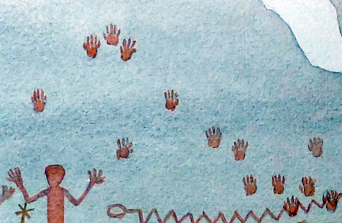
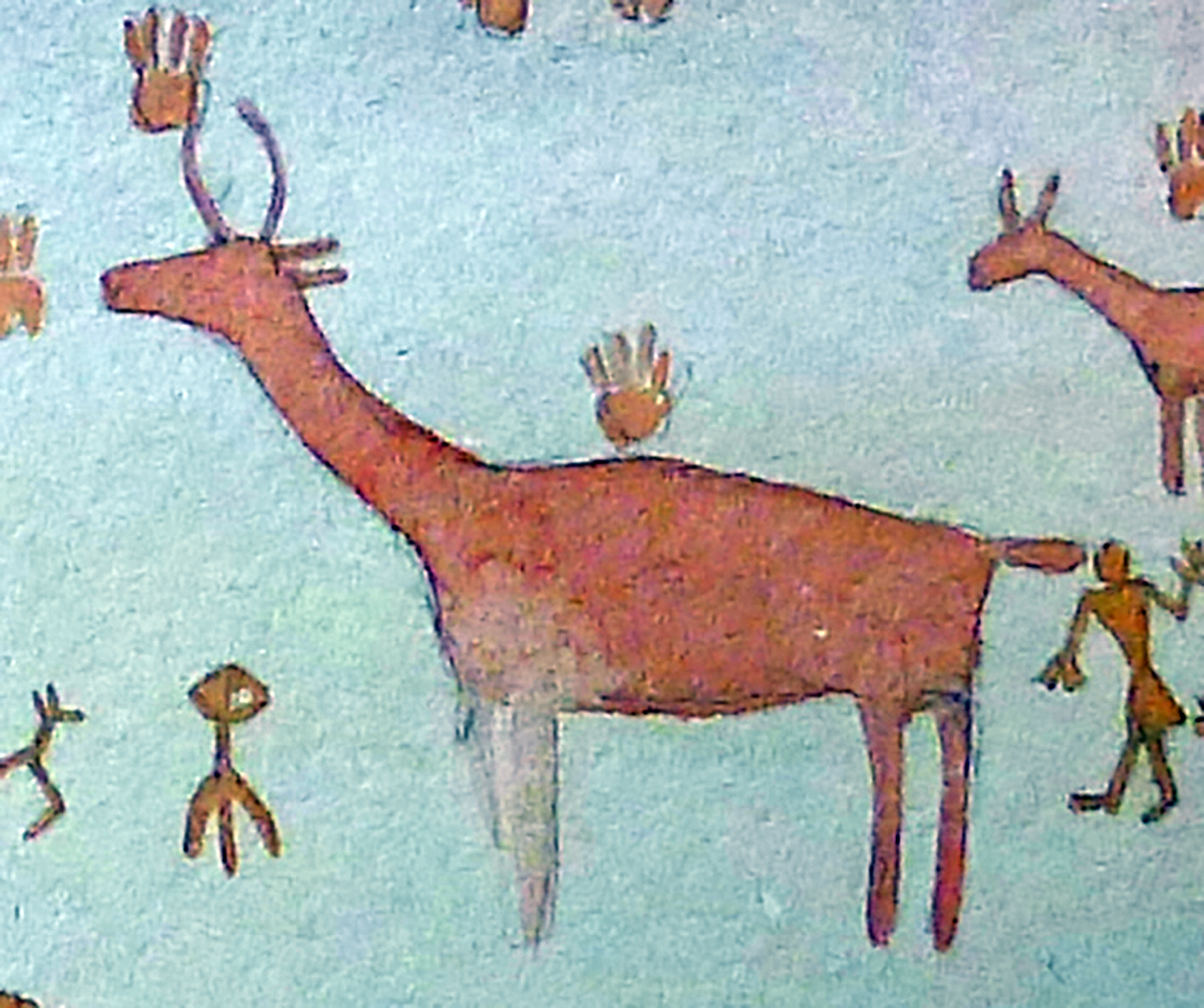
Seminole Watering Hole is one of the two type-sites for Red Monochrome Style pictographs (the other being Painted Shelter [VV78]). This style is defined by realistically portrayed anthropomorphs frontally posed, typically depicted in a “hands-up” position with splayed digits and bent elbows (Turpin 1986). Anthropomorphs are drawn more realistically and with less adornment than the more common Pecos River Style figures. Typically Red Monochrome figures are painted solely with red paint, but there are some possible examples of yellow paints (Kirkland and Newcomb 1967:83). Some figures are seen wielding bows, digging sticks, and knives. Due to the presence of bows, we can determine that Red Monochrome dates to the Late Prehistoric period (after ~A.D. 1000) in the Lower Pecos. There has been one radiocarbon date on a figure that is similar to Red Monochrome Style that resulted in an age of 1315 ±50 RCYBP (Ilger et al. 1995:Table 2). Red Monochrome also exhibits a larger variety of distinct zoomorphs than other pictographs styles in the region, such as canines, turkeys, fish, rabbits, deer, and felines.
 as seen in real-color (left) and DStretch CRGB enhancement (right) The two anthropomorphs are wielding a bow (figure on right) and probable knife (figure on left).")
 as seen in real-color (left) and DStretch CRGB enhancement (right). This anthropomorph appears to be female, and is depicted with hair buns and a dress.")
 enhanced with DStretch CRGB color channel.")
Alexandria Documentation
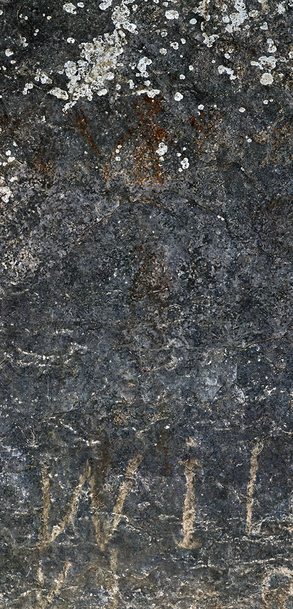
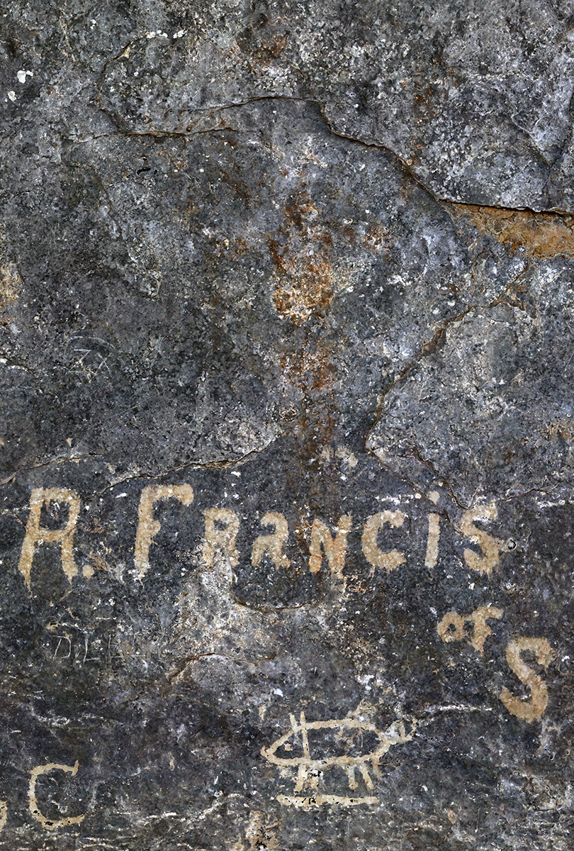
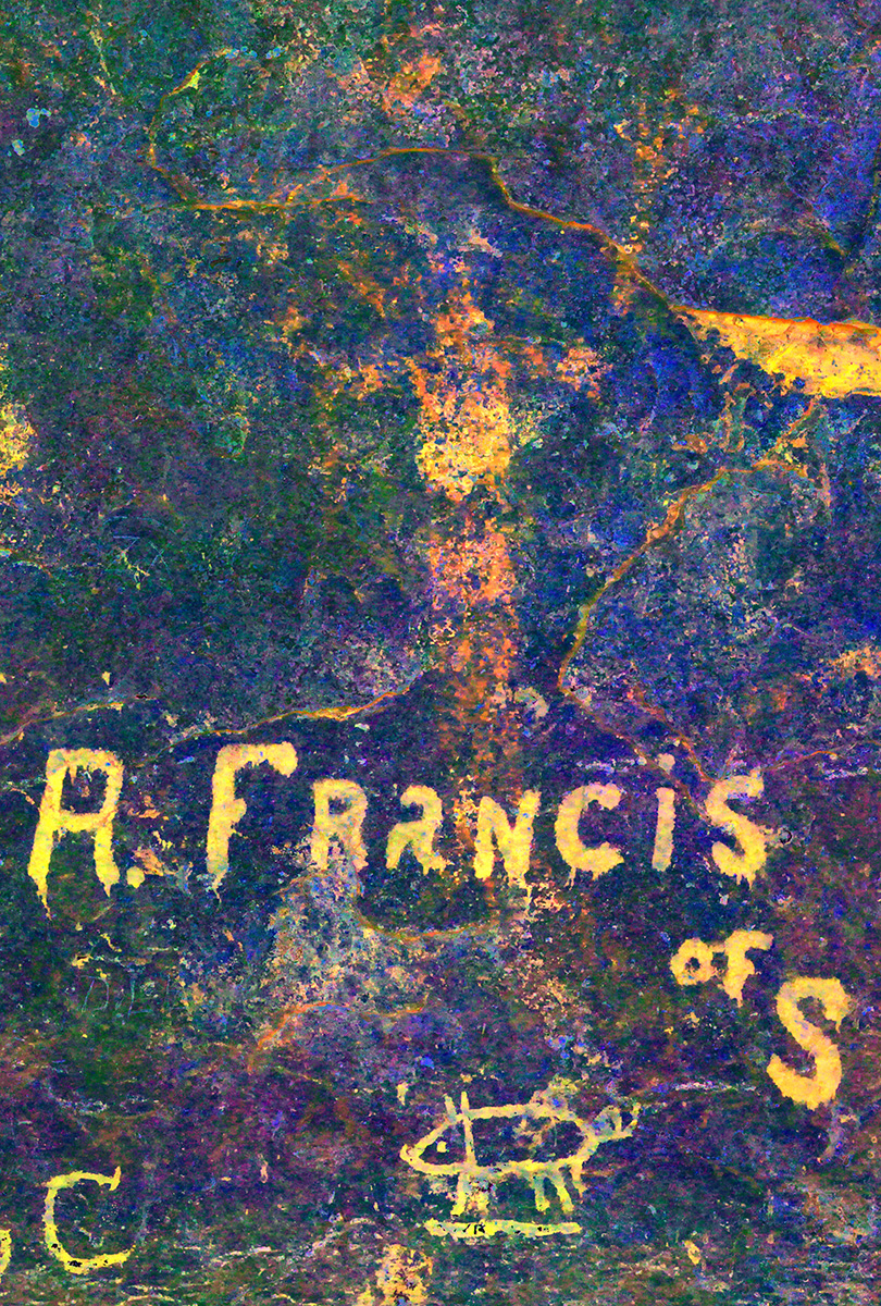
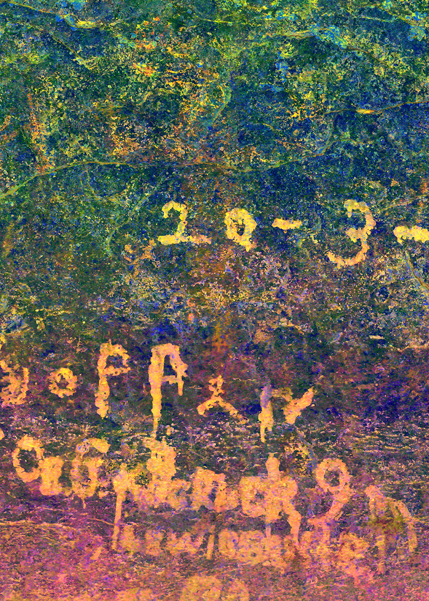
In 2018 Shumla documented the rock art at Seminole Watering Hole as part of The Alexandria Project. Due to the poor preservation, coupled with the large extent of the panel, Seminole Watering Hole was one of the more challenging sites documented thus far on the Alexandria Project. The first step was to match up Kirkland’s renderings with what we could observe in the field. This was made more difficult because Kirkland did not include any of the historic railroad or ranching graffiti, which are the most prominent images at the site.

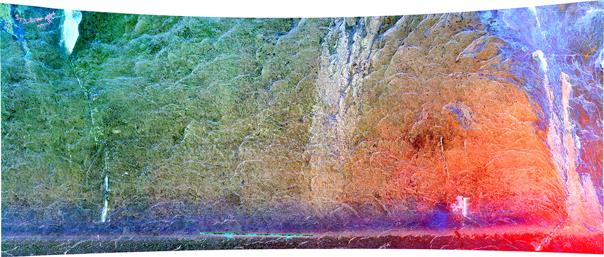
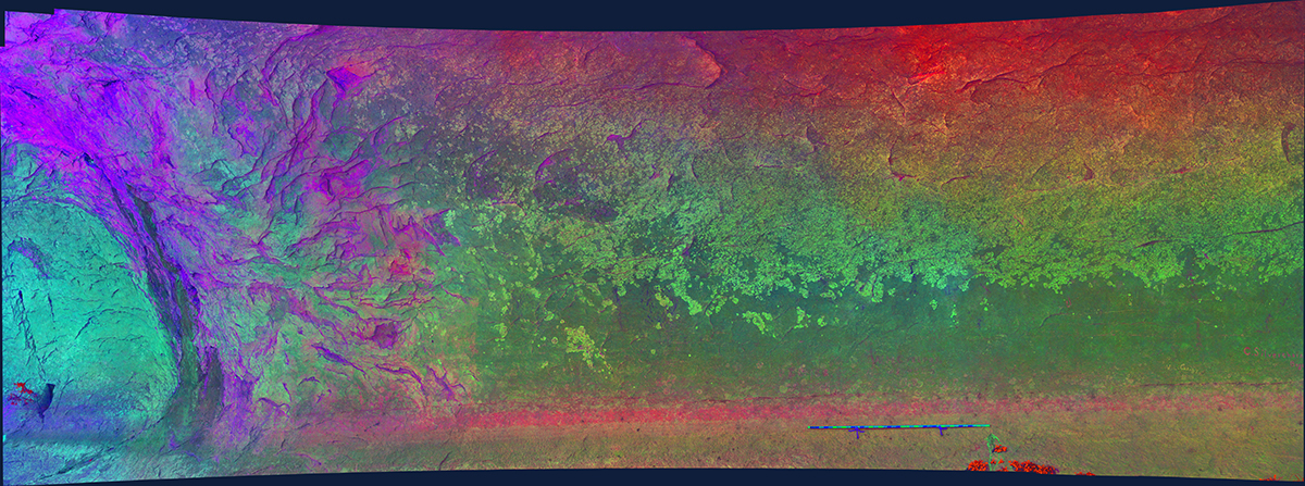
Once we identified the extent of each of Kirkland’s renderings, the next step was to produce gigapanoramas (gigapans) and a 3D model of the rock art panel. We were able to produce a single 3D model of the entire pictograph panel, but because the pictographs at Seminole Watering Hole are so extensive, we divided the panel into 12 different gigapan sections (Sections 1-12). The gigapan sections begin on the downstream end and moving upstream (panel-right). Each one of these sections received an individual gigapan, and each gigpan was subsequently enhanced using DStretch.
To manipulate the 3D model:
- Click on the “Play” symbol in the center of the image.
- Use the scroll-wheel on the mouse to zoom in and out.
- Left-click and hold to rotate the model around the mouse cursor.
- Right-click and drag to re-position the model.
In the bottom-right corner are two opposing arrows. Click these arrows to make the 3D model full-screen.
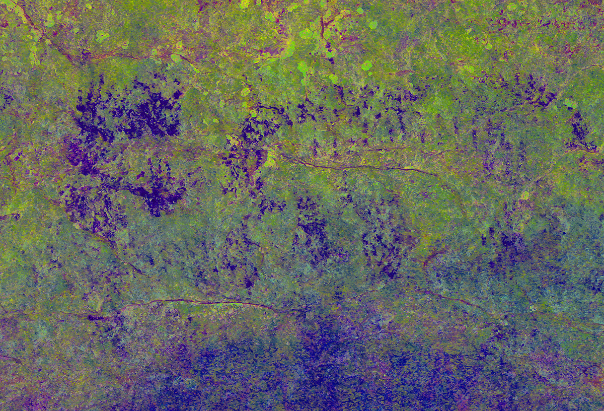
Gigapanoramas
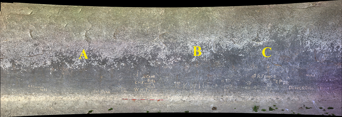
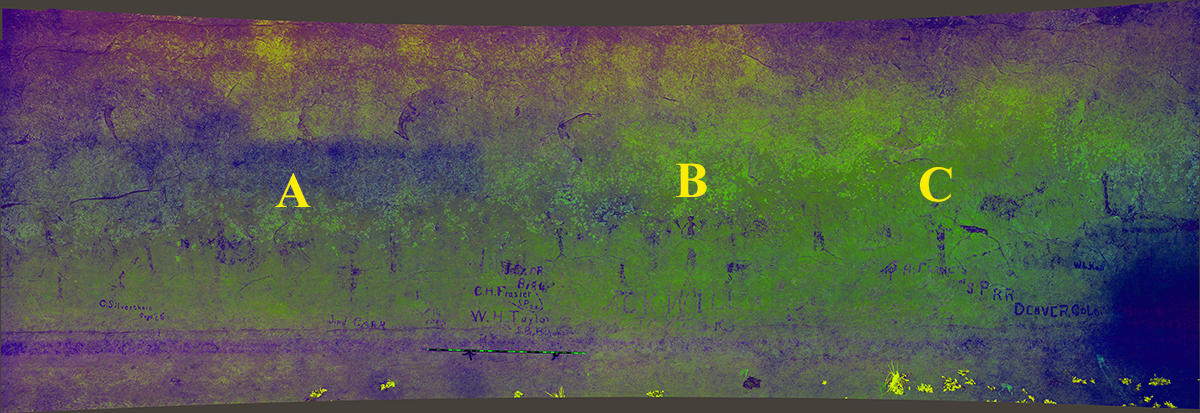
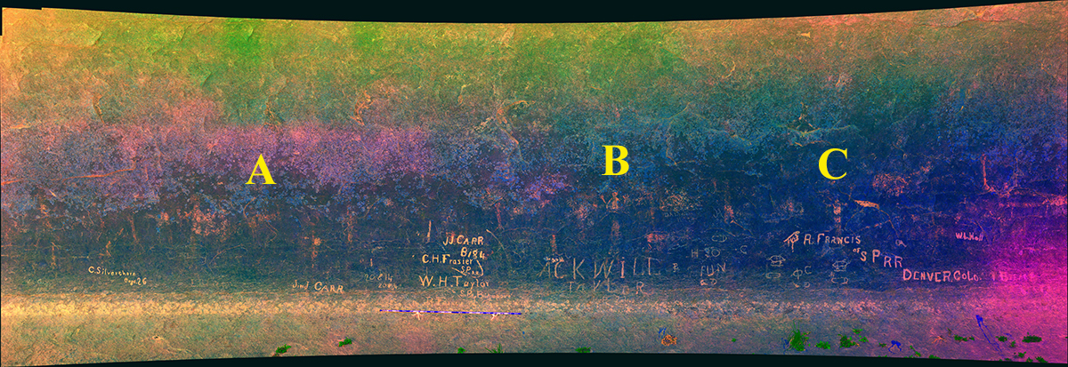
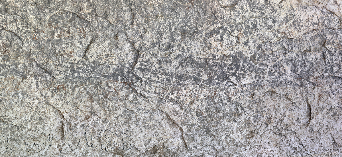
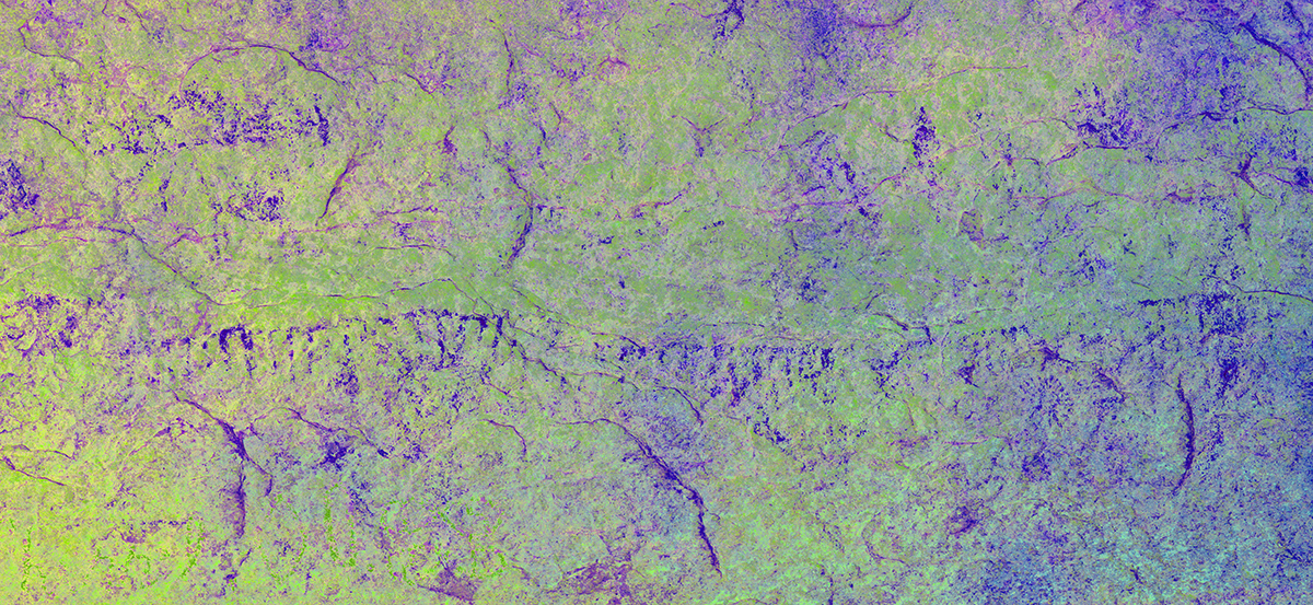
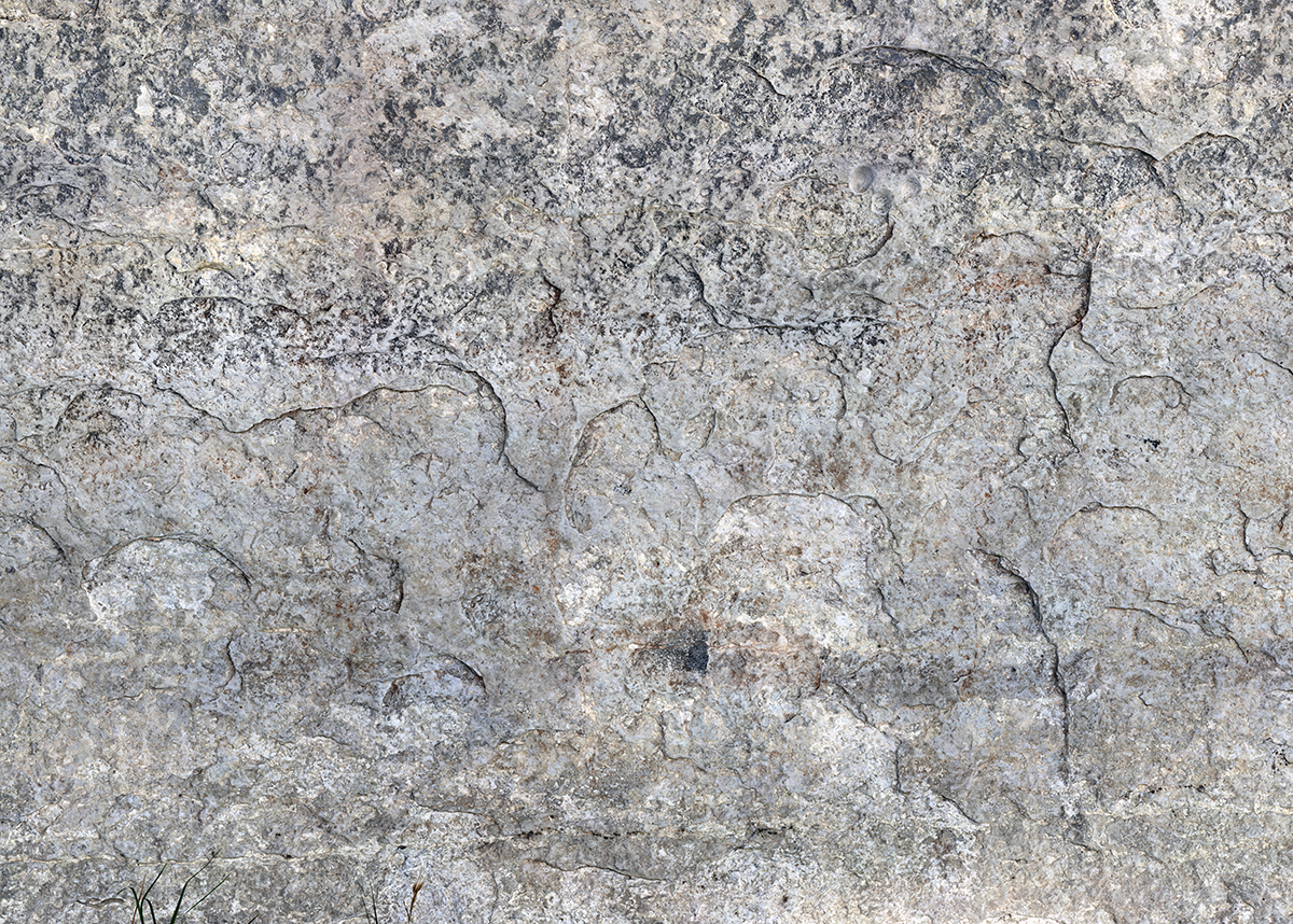
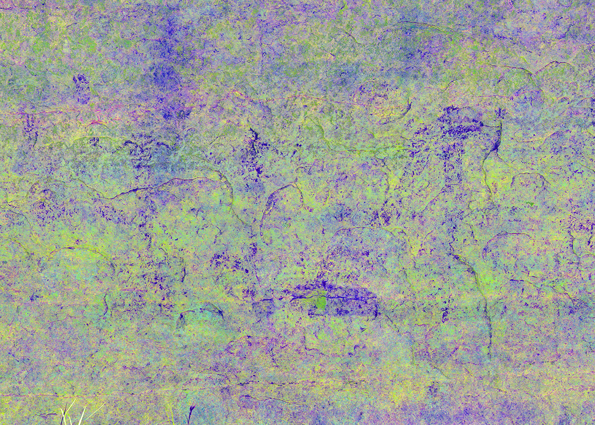
The 12 gigapan sections span the entire length of the shelter wall, and are shown below in real-color and DStretch versions (click on the photographs to make the images larger, and then click through to the different enhancements). The full-resolution gigapan images are accessible from our GigaPan profile (click here). For comparison, Kirkland’s watercolor images are provided. The letters (A-W) show the locations of the same figures in Kirkland’s watercolors and Shumla gigapans.
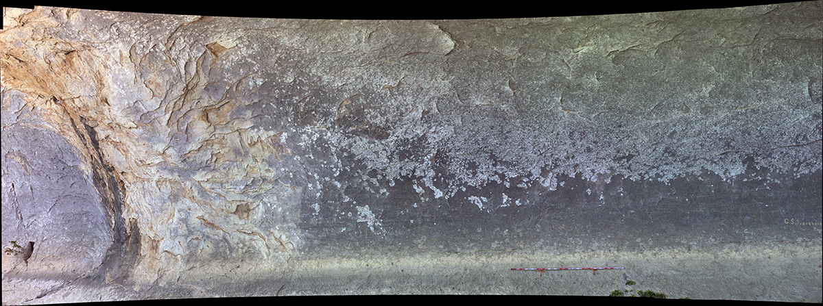
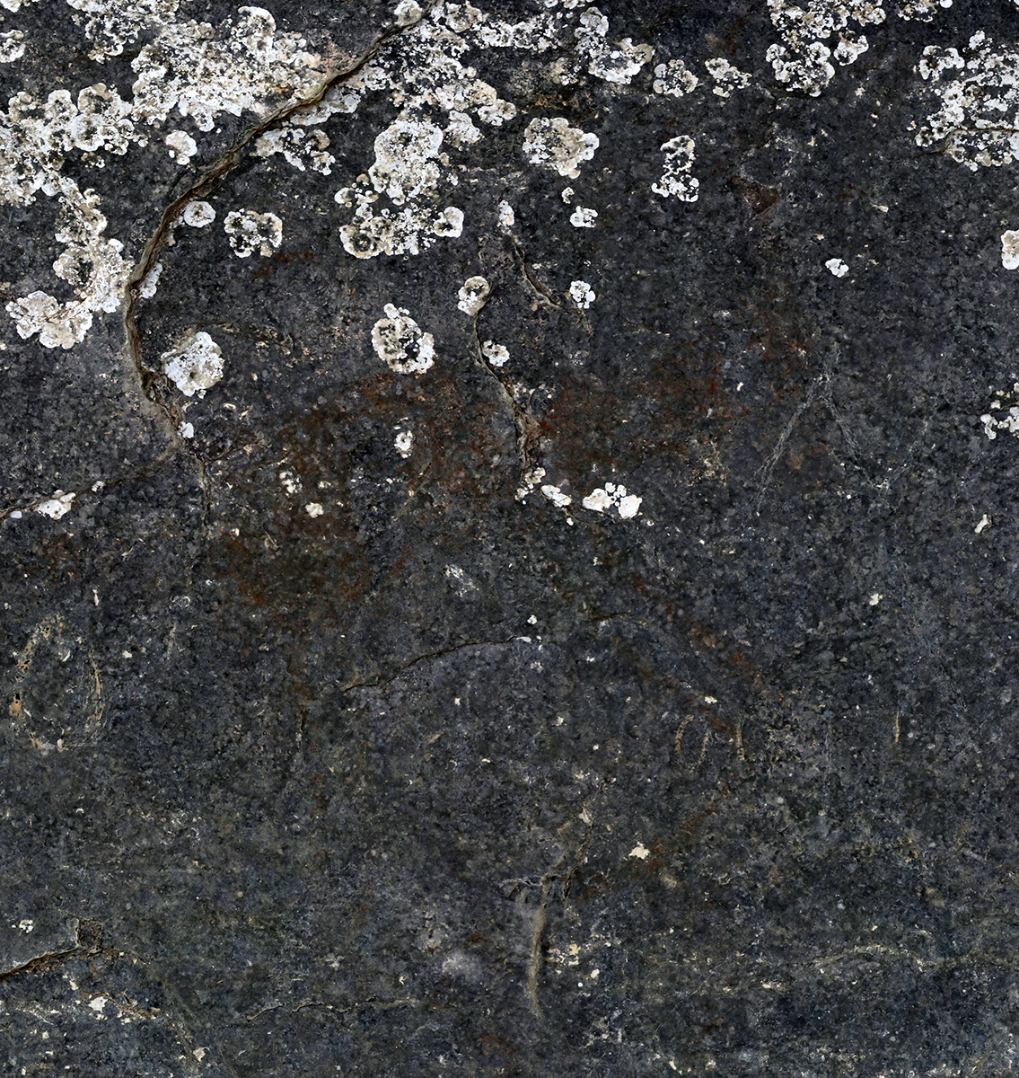
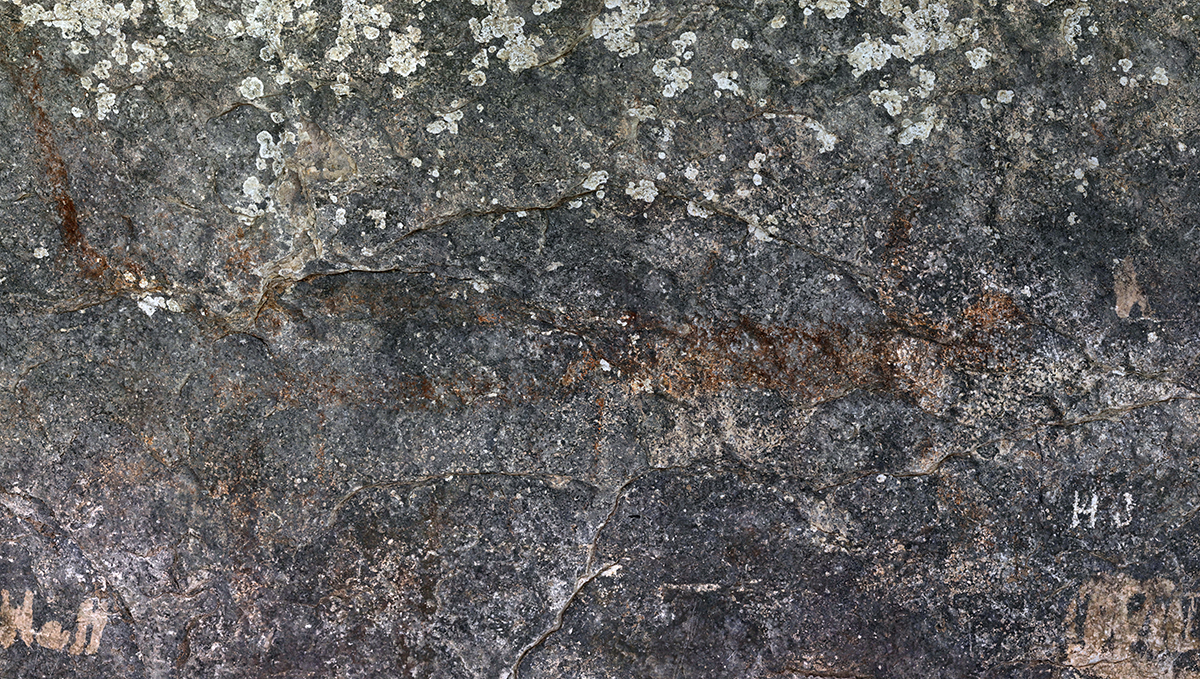
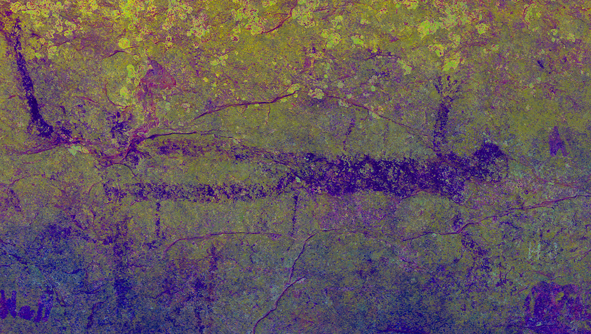
Sections 1 and 2 are on the far downstream end of the site, and are outside of the true rockshelter. These sections were not illustrated by Kirkland, likely because there is very little preserved imagery. Section 3 is the first area within the rockshelter, and although paint is visible, it is very difficult to discern. The preservation improves after Section 3.

Section 1
Section 2
Section 3

Kirkland’s Rendering No. 1 and Gigapan Section 4
Kirkland’s rendering No. 1 (Kirkland and Newcomb 1967:Plate 43) includes images on the downstream end of the shelter interior. The letters in the rendering correspond to the same figures in the Section 4 gigapanorama.

Section 4
Figure A
Figure B

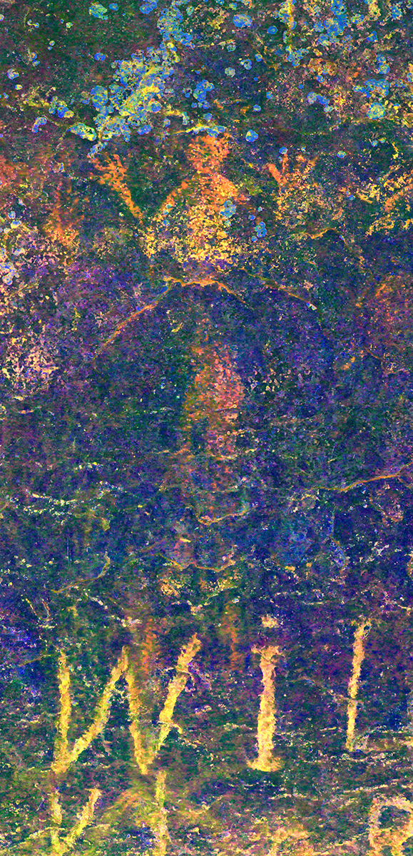
Kirkland’s Rendering No. 2 and Gigapan Section 5
Kirkland’s rendering No. 2 (Kirkland and Newcomb 1967:Plate 44) includes images on the downstream end of the shelter interior, including a horizontally-oriented anthropomorphic figure. The letters in the rendering correspond to the same figures in the Section 4 and Section 5 gigapanoramas.
.")
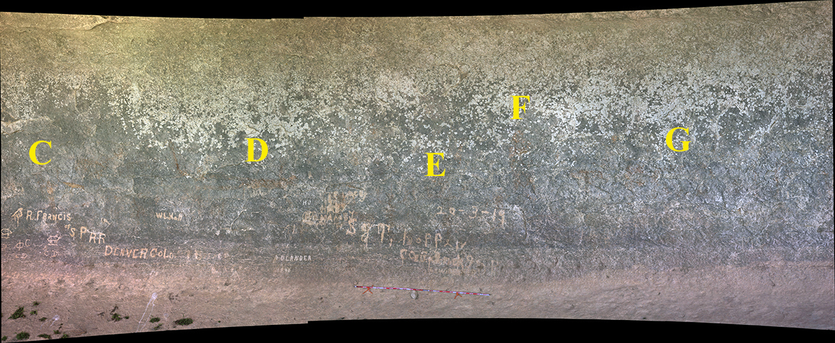
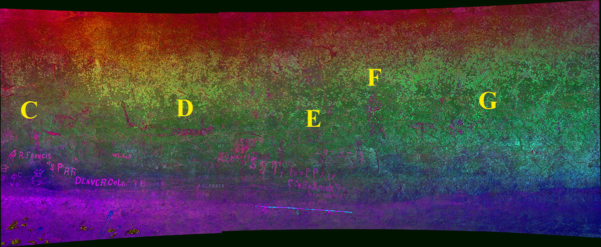
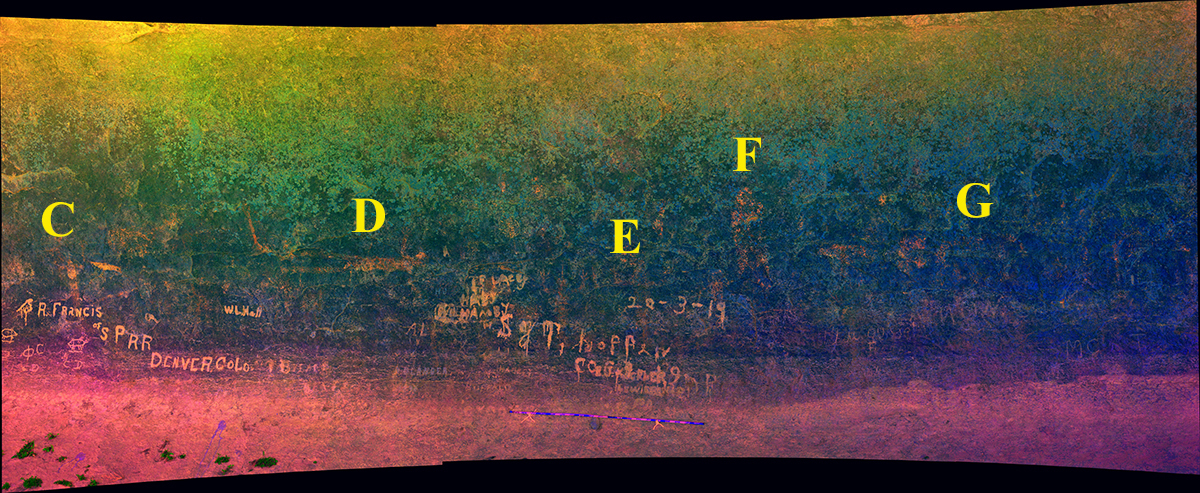
Figure C
Figure D
Figure E
Figure F

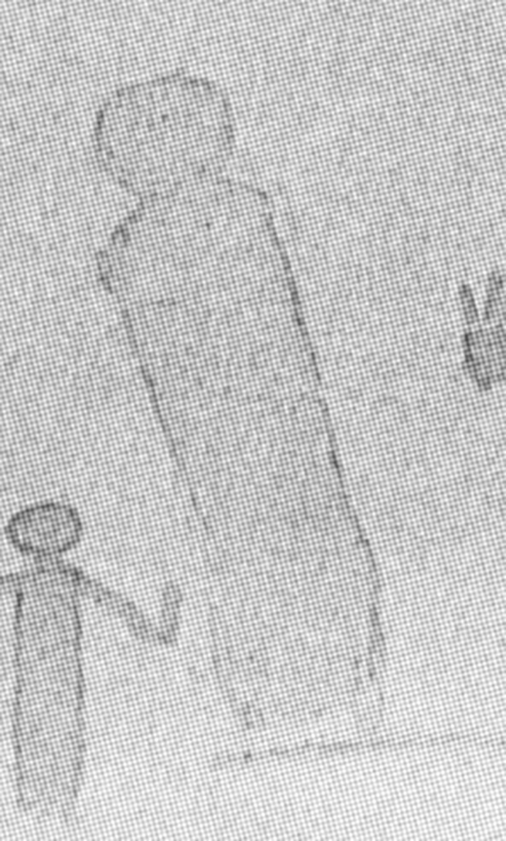
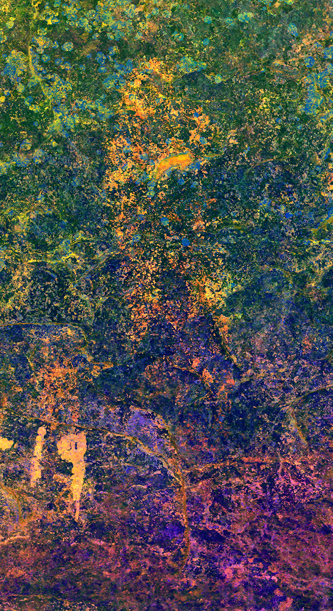
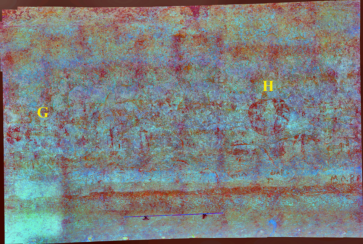
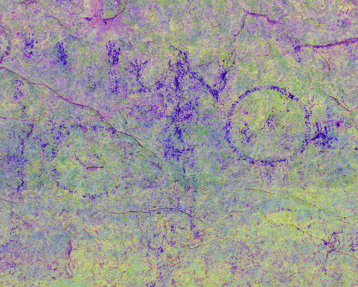
Kirkland’s Rendering No. 3 and Gigapan Section 5a
Kirkland’s rendering No. 3 (Kirkland and Newcomb 1967:Plate 45) includes images in the central portion of the rockshelter. The letters in the rendering correspond to the same figures in the Section 5 and Section 5a gigapanoramas.
.")
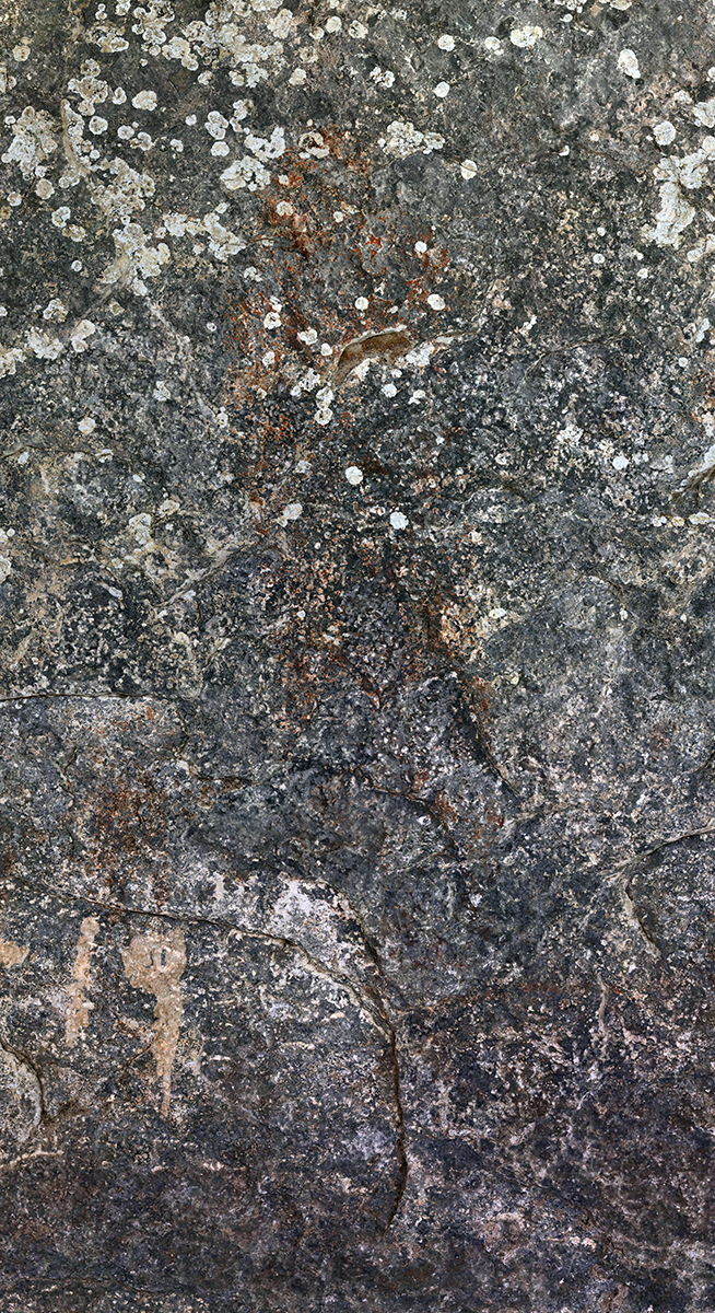
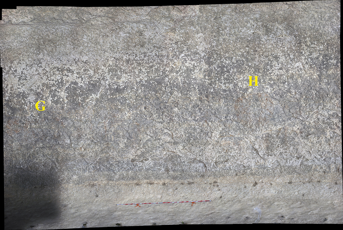
Section 5a
Figure G
Figure H
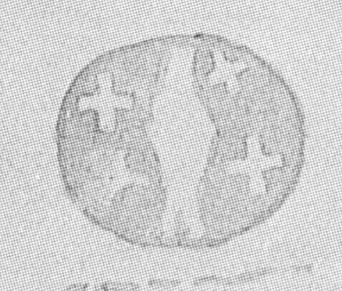
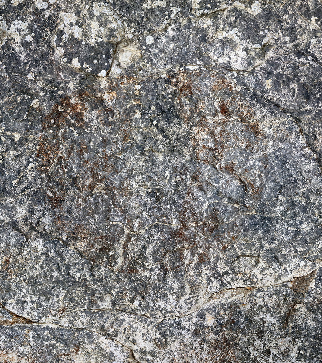
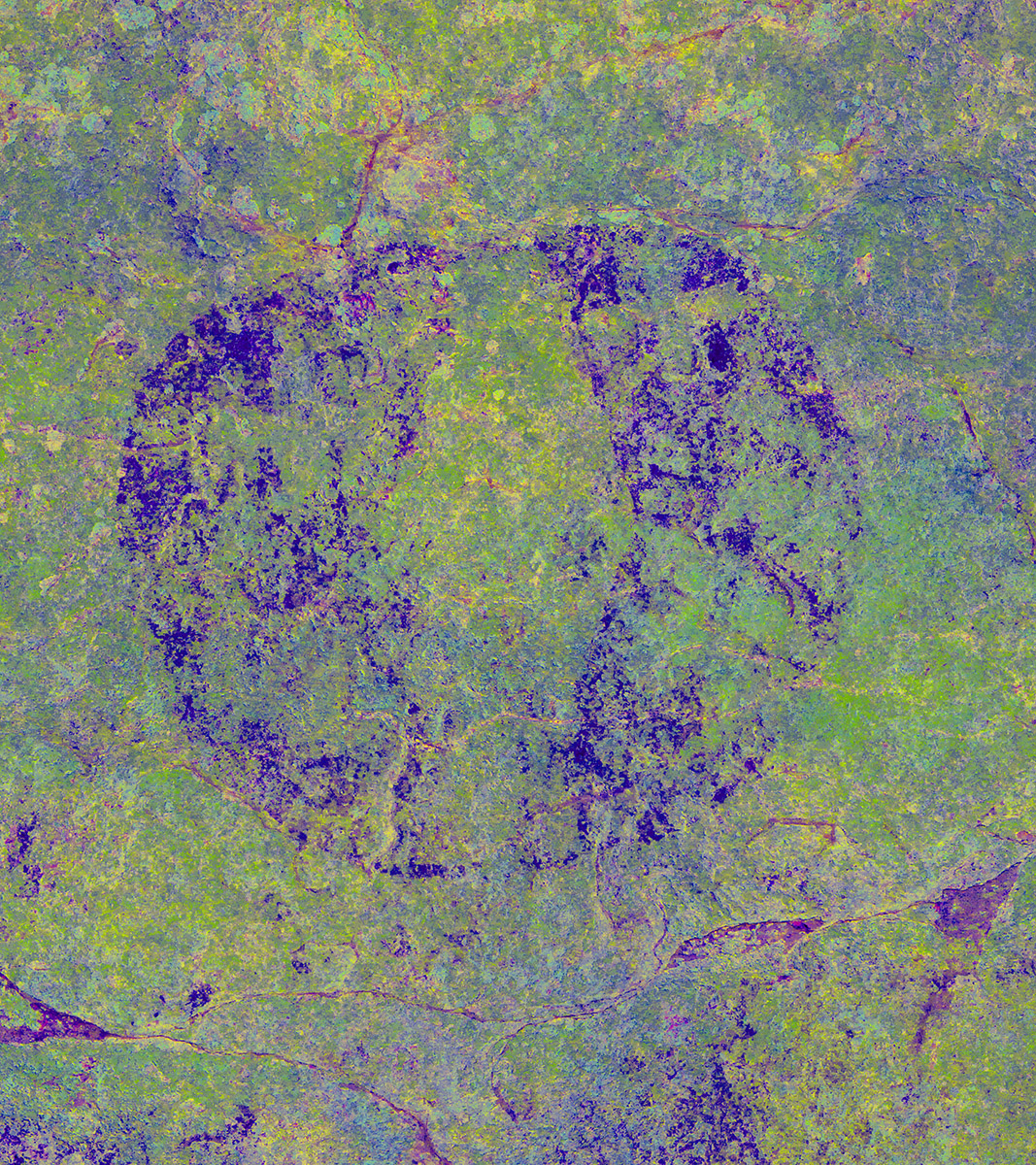
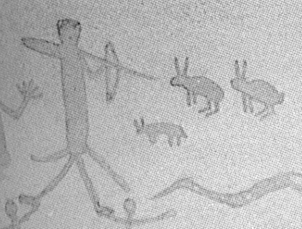
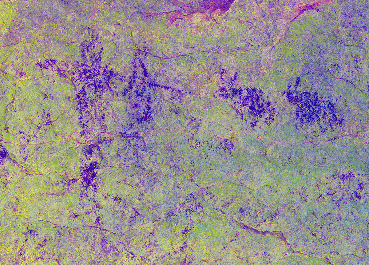
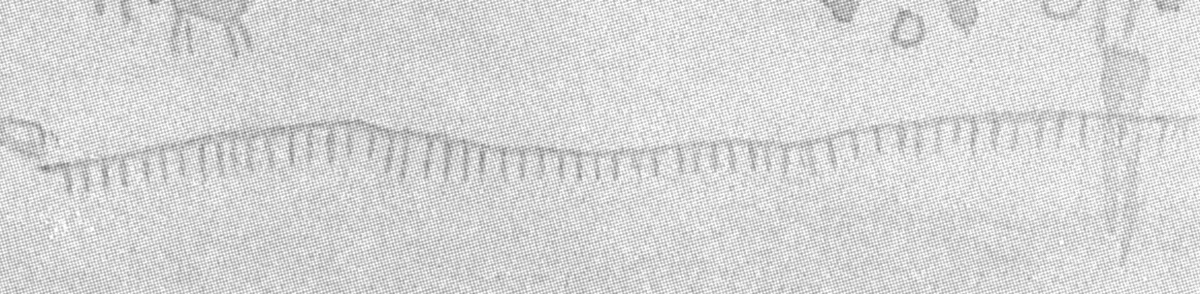
Kirkland’s Rendering No. 4 and Gigapan Section 6.
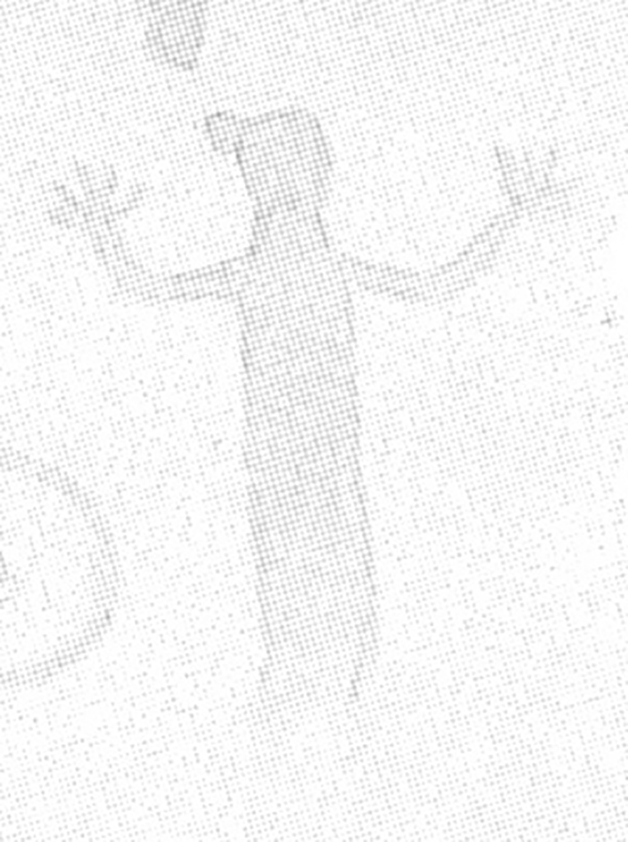
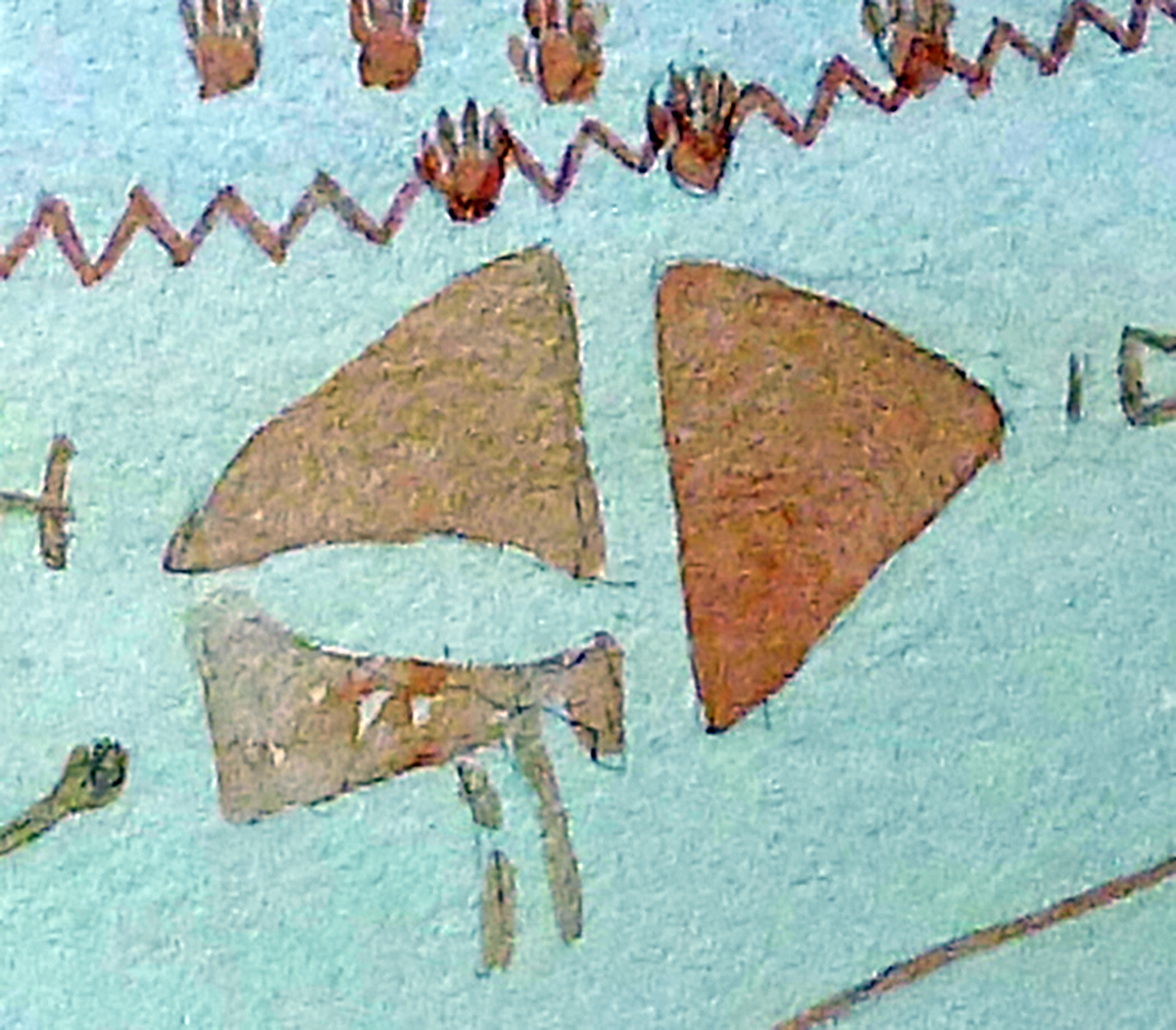
Kirkland’s rendering No. 4 (Kirkland and Newcomb 1967:Plate 46) includes better-preserved imagery, including one of two bow-wielding figures at the site. The letters in the rendering correspond to the same figures in the Section 6 gigapanorama.
.")
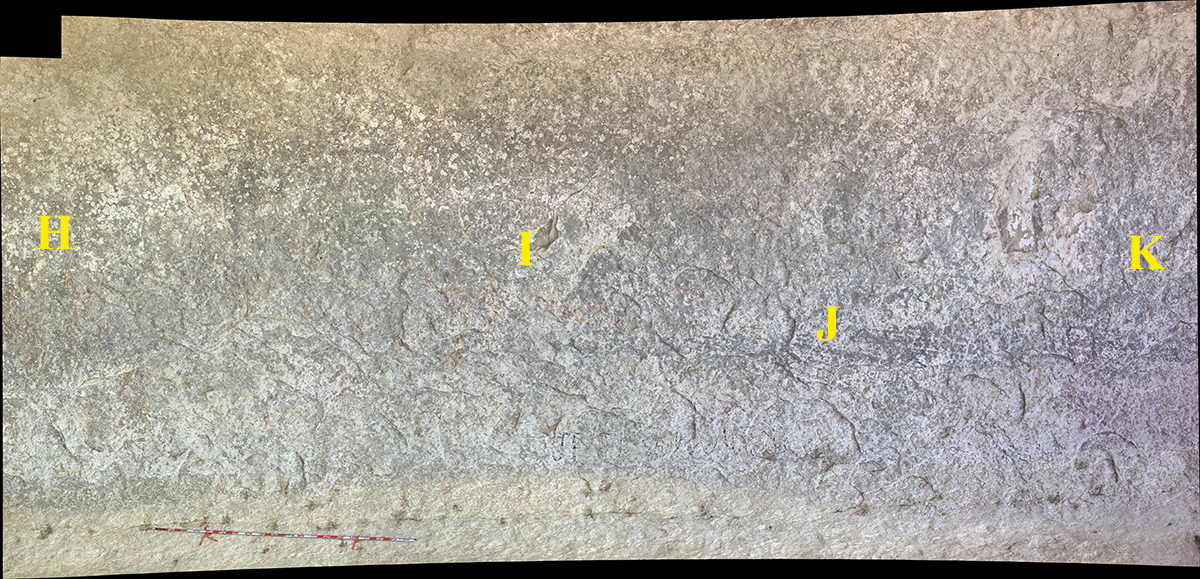

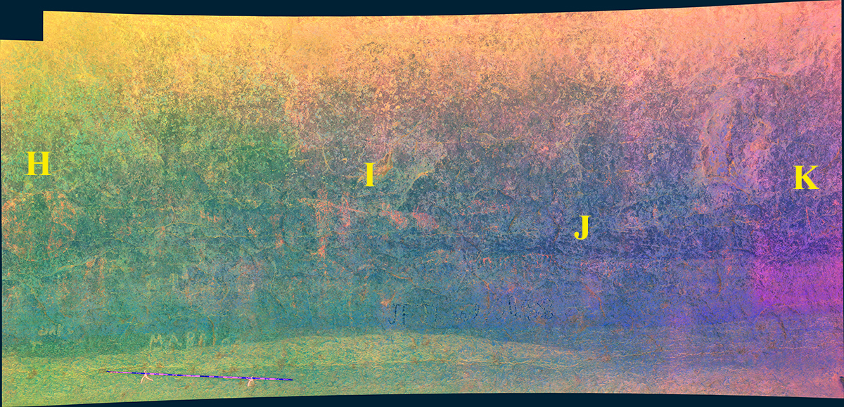
Figure I
Figure J
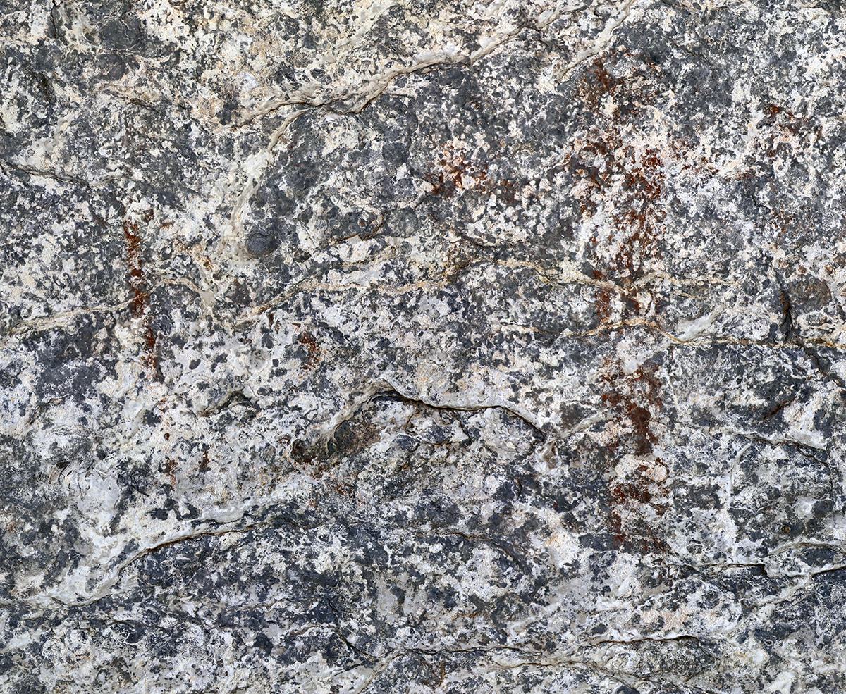
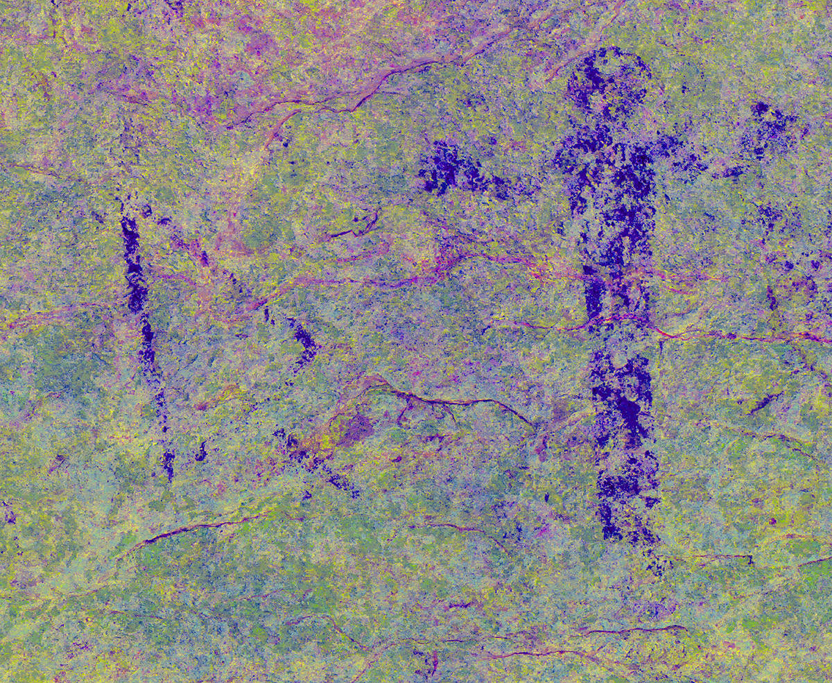
Figure K
Kirkland’s Rendering No. 5 and Gigapan Section 7
Kirkland’s rendering No. 5 (Kirkland and Newcomb 1967:Plate 43) includes some of the better-preserved imagery at Seminole Watering Hole. The letters in the rendering correspond to the same figures in the Section 7 and Section 8 gigapanoramas.

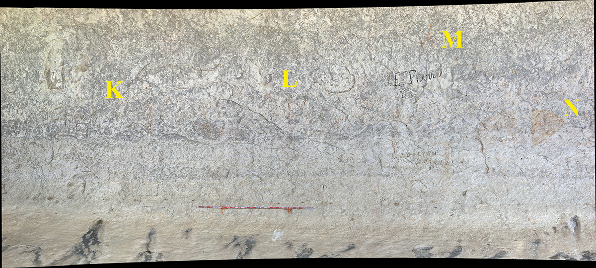
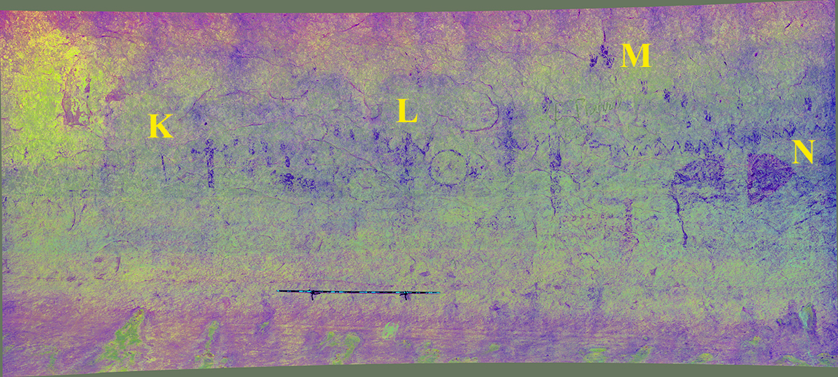
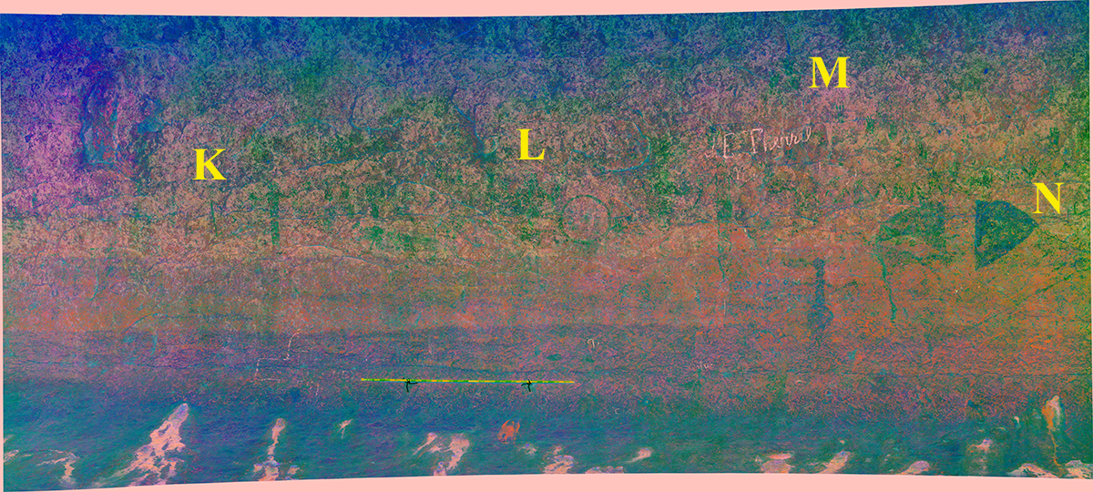
Figure L
Figure M
Figure N
Kirkland’s Rendering No. 6 and Gigapan Sections 8 and 9
Kirkland’s rendering No. 6 (Kirkland and Newcomb 1967:Plate 44) includes the second bow-wielding figure on the upstream end of the shelter. The letters in the rendering correspond to the same figures in the Section 8 and Section 9 gigapanoramas.
.")
Section 8
Section 9
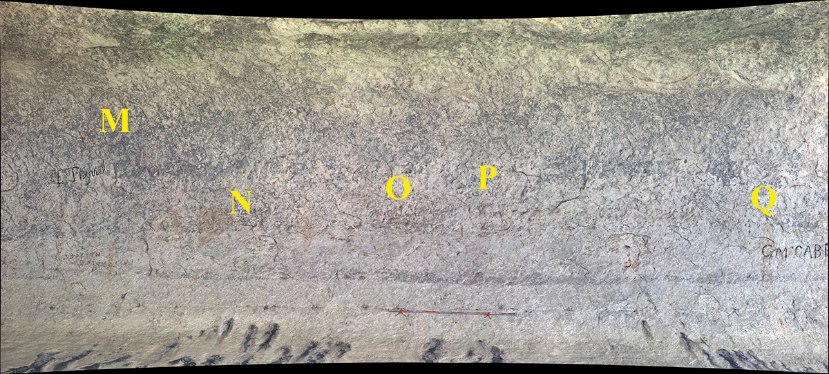
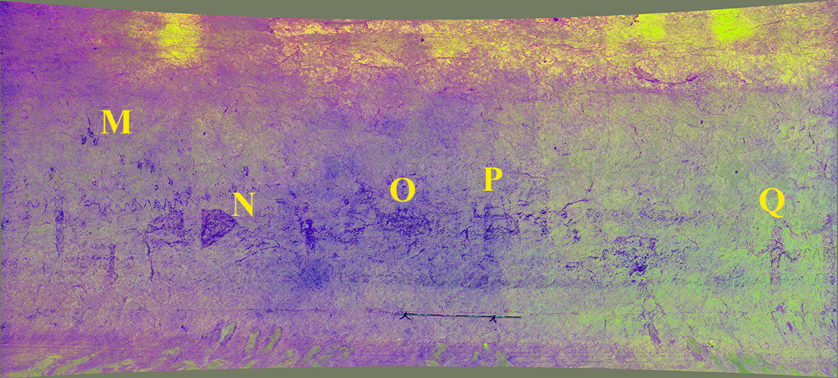
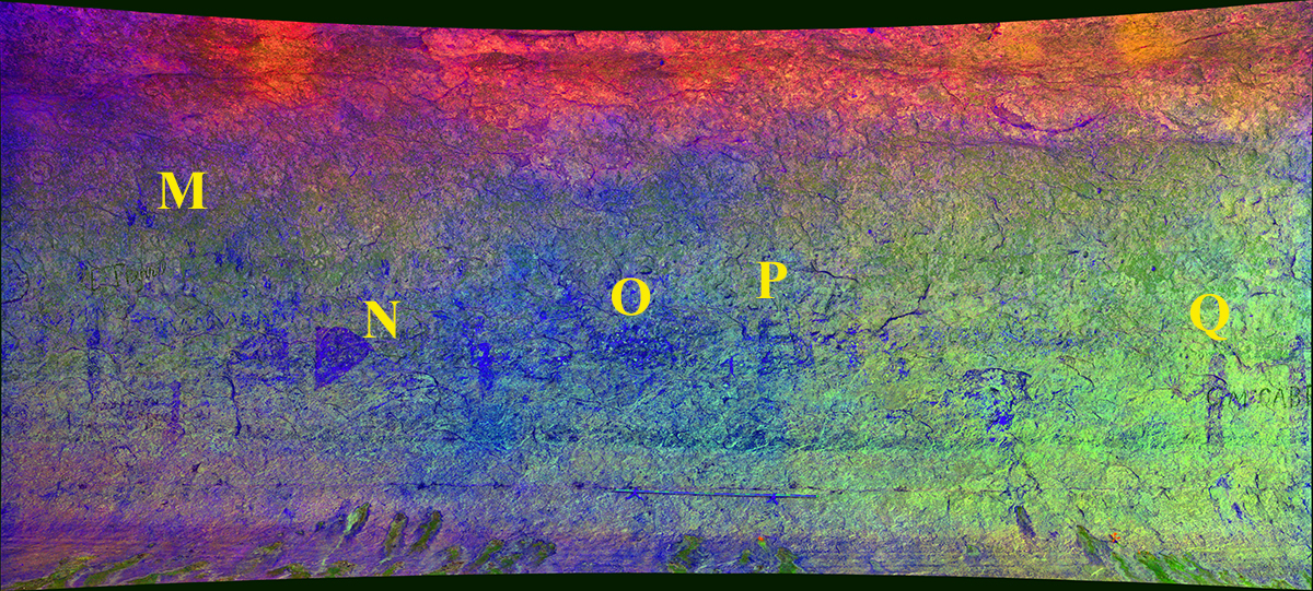
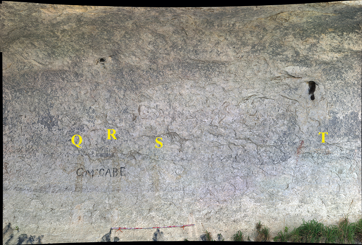
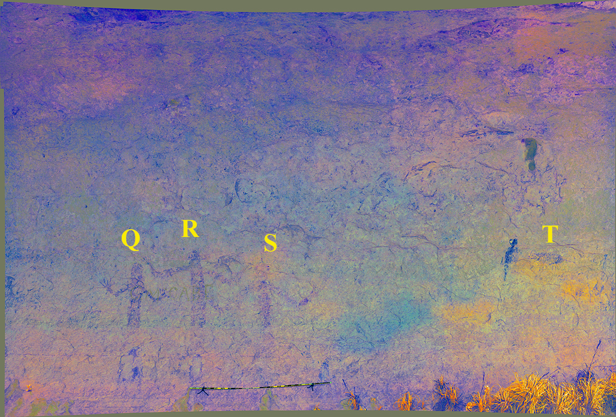
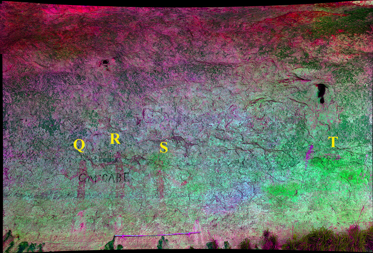
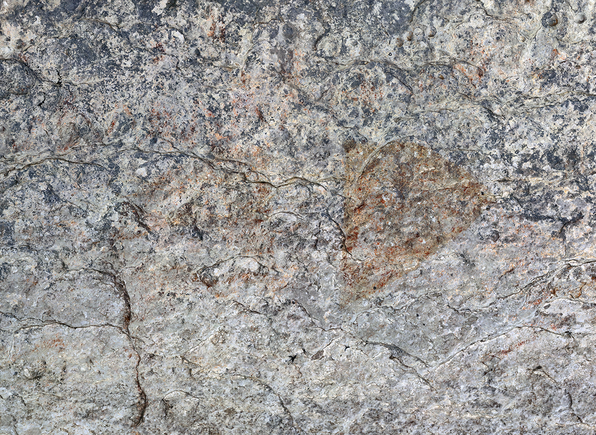
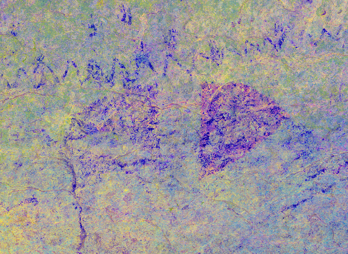
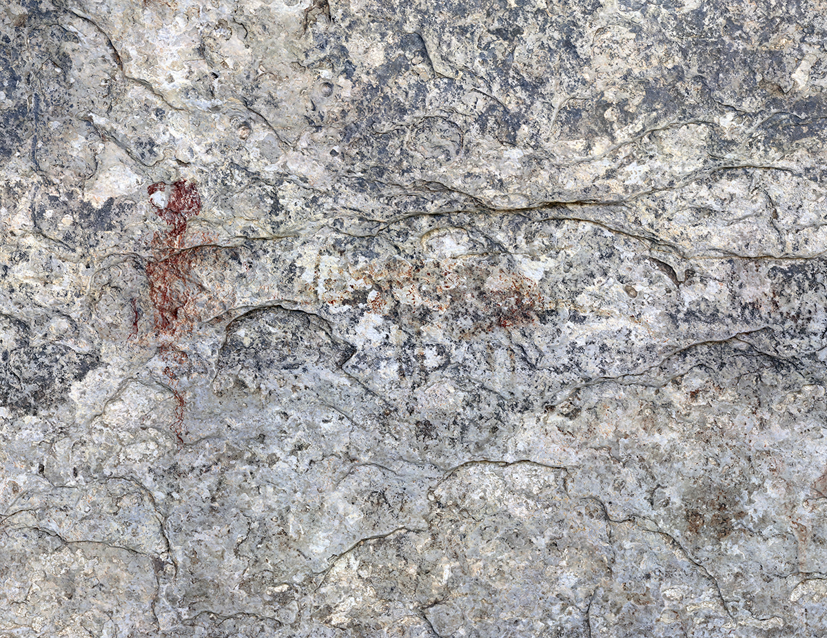
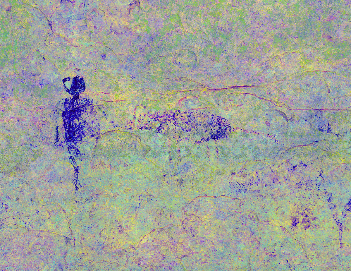
Figure O
Figure P
Figures Q, R, and S


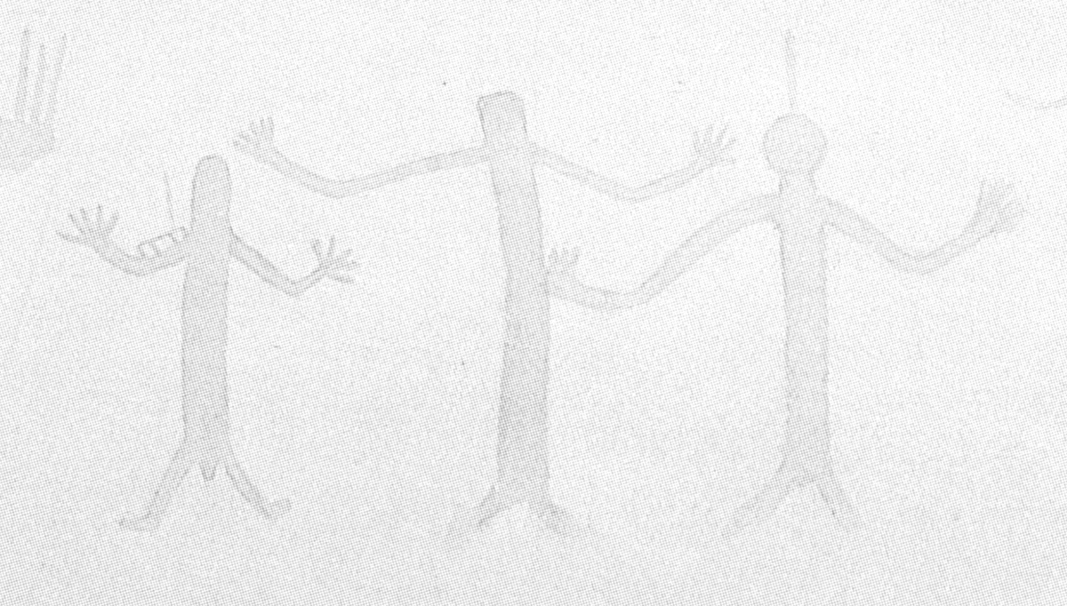
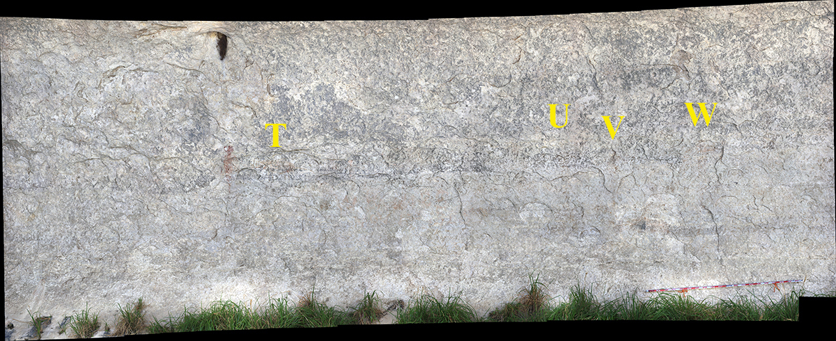
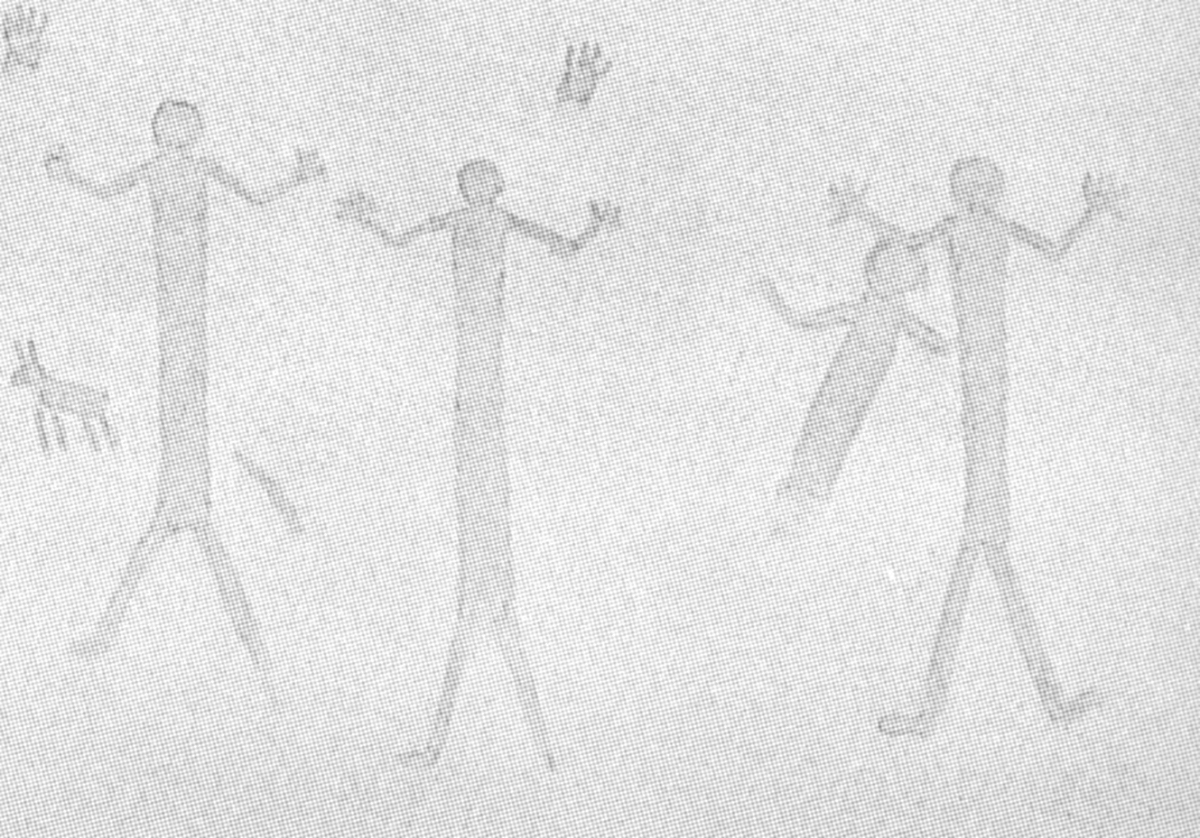
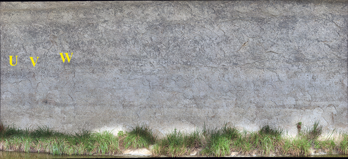
Kirkland’s Rendering No. 7 and Gigapan Section 10
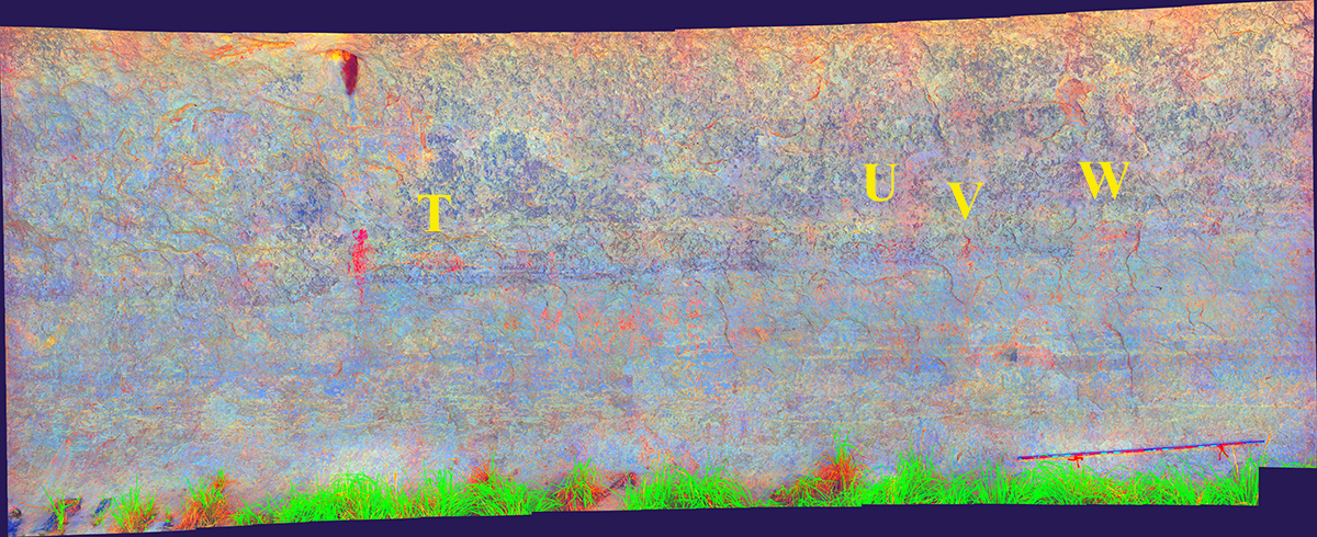
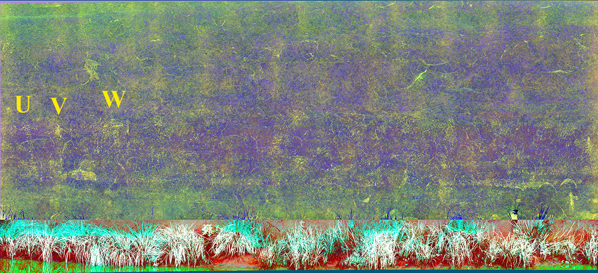
Kirkland’s rendering No. 7 (Kirkland and Newcomb 1967:Plate 45) was the last section of figure’s Kirkland included in his renderings. These figures are virtually invisible without the assistance of DStretch. The letters in the rendering correspond to the same figures in the Section 9 and Section 10 gigapanoramas.
.")
Section 10
Figure T
Figures U, V, and W
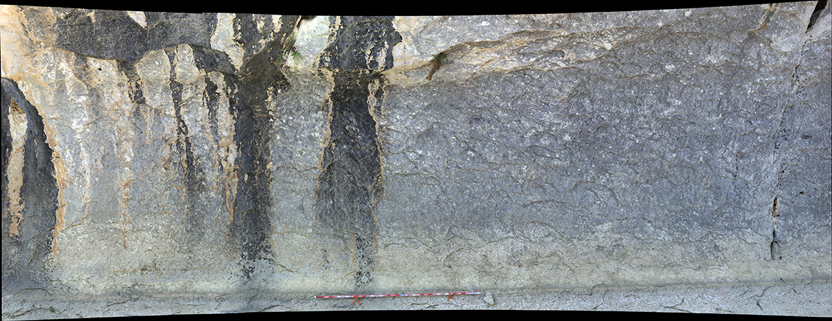
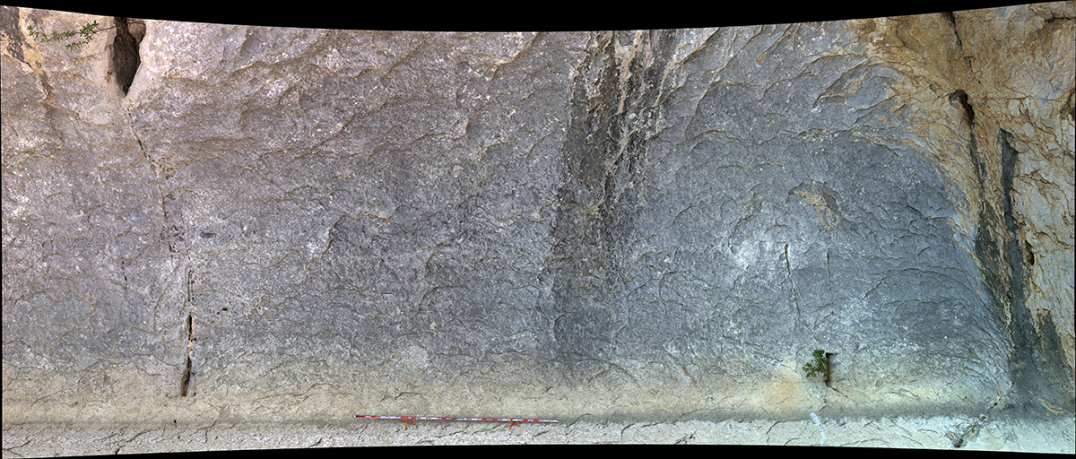
Sections 11 and 12
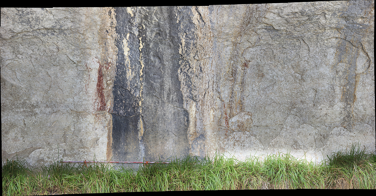
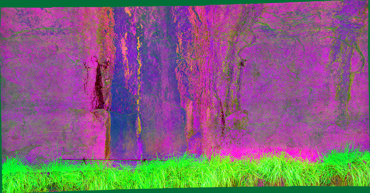
Sections 11 and 12 are on the far upstream end of Seminole Watering Hole. Kirkland did not include these areas in his watercolor renderings. The lone red anthropomorph within Section 12 is the best-preserved painted figure in the entire shelter.
Section 11
Section 12
Discussion
Many of the pictographs at Seminole Watering Hole are nearly impossible to see in the field. In fact, the only way we were able to identify the locations of many of the figures illustrated by Kirkland was to DStretch the gigapans in the lab. Although paint is still preserved in the areas where Kirkland illustrated many figures, we were unable to make out many of the finer details illustrated by Kirkland (see Figures U, V, and W above). In several cases, portions of figures Kirkland illustrated are completely gone (see Figures K and T above). However, in one instance (Figure P), we were able to identify attributes that Kirkland did not fully recognize during his documentation.

By comparing Kirkland’s renderings to the figures still discernible in the gigapans, we estimate that less than 50% of the figures/motifs Kirkland illustrated are still preserved to the same level of detail Kirkland documented. In just under 90 years the rock art at Seminole Watering Hole has experienced rapid degradation likely due to a combination of flooding, spring activity within the site, and lichen growth on the shelter wall. Continued documentation of endangered sites, like Seminole Watering Hole, is a vital goal of the Alexandria Project so that we can digitally preserve what is left for future study and education.
***A PDF version of the TAS poster presented by Hailey and Caitlin is available here**
References Cited
Ilger, Wayne, Marian Hyman, John Southon, and Marvin Rowe. 1995 Dating Pictographs with Radiocarbon. Radiocarbon 37(2):299-310.
Kirkland, Forrest and W.W. Newcomb, Jr. 1967 The Rock Art of Texas Indians. University of Texas Press, Austin.
Turpin, Solveig A. 1986 Pictographs of the Red Monochrome Style in the Lower Pecos River Region, Texas. Bulletin of the Texas Archeological Society 55:123-144.
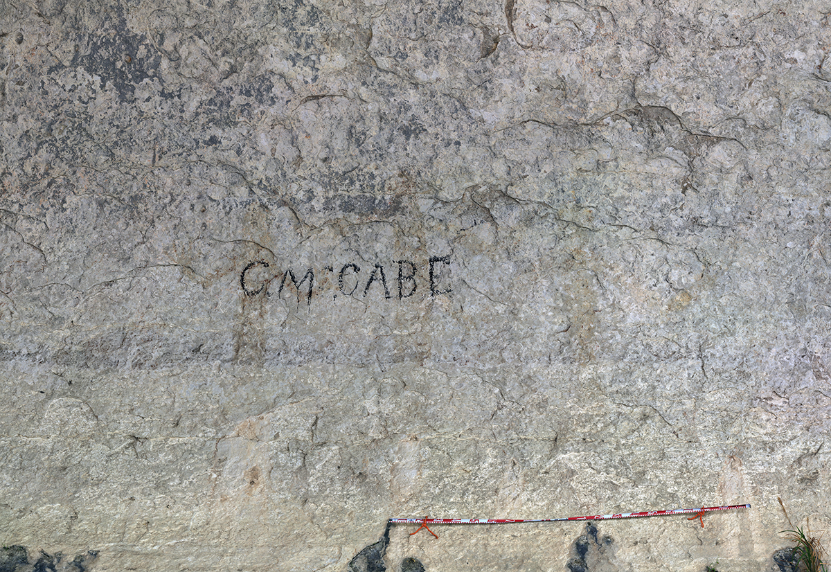
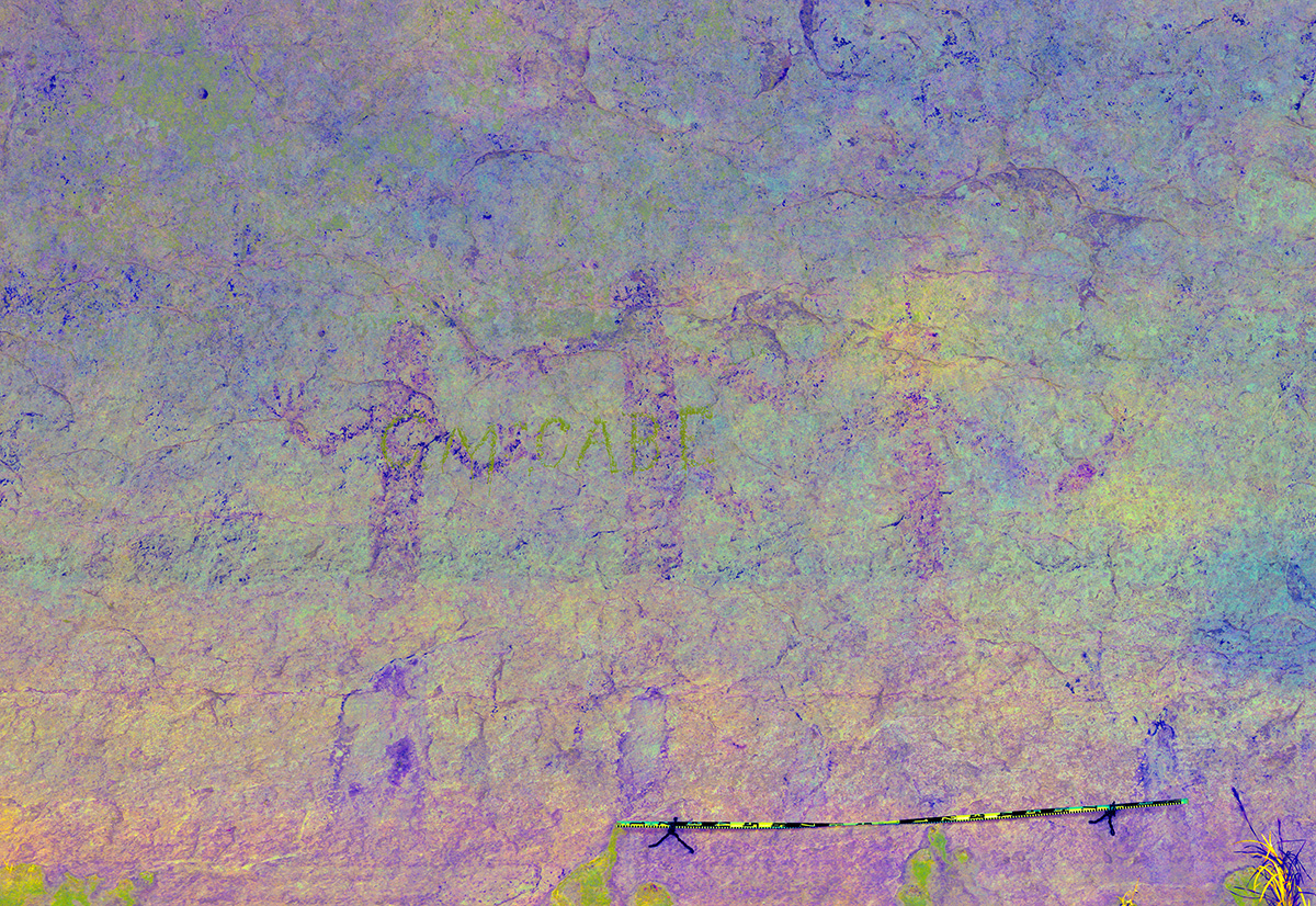
I am absolutely amazed at the capabilities this “blog” contains. Using the 3 dot format on the photos is excellent. Great work with the D-stretch and pulling the right hues to expose the hidden secrets. I will use this to prepare for the next Upper Canyon Tour. I will be able to locate much more than the 3 figures beneath CM Cabe. I had no idea the technology could be this user friendly. Fascinating to see how much remains of the pictographs Kirkland documented. Keep up the incredible work and I look forward to reading all your blogs!